
|
It felt like a long time since I've seen any 'cool skies' over N. Ireland especially anything weather related so photo opportunities of late have been very few and far between. The last dramatic convective skies and thunder I experienced was during September 2025. Since then and into 2026 things have been rather quiet despite being always on the look out. Barely a day went by that I didn't have my DSLR or drone close to hand with fully charged batteries, ready in case something unexpected happened. Winter had been fairly bland overall and from December to February it has been cold, cloudy and uneventful.
However I always look forward to Spring every year and that time has now arrived. The days are much longer and solar heating is beginning to affect the land and influence the weather. This is the earliest phase of the new convective season which I had been waiting on for months. Based on previous experience I usually experience cool cloud scenes and storms from late April or May onwards as we fully move into the warm season however the month of March can offer surprises too. Since I began storm chasing on July 2007 I've witnessed two thunderstorm events inland during March so this isn't a common thing however cool convective skies, even without thunder, can be much more plentiful if the appropriate pattern is present. March is technically still cold season and it's these cold core set-ups which usually produce the goods and as luck would have it we where in the middle of a cold and unstable air flow which was the story behind the two days which follow.
March 25th was one such day, it was a classic low instability-high shear atmosphere with 100j/kg of ML CAPE and 95 3km CAPE with -30c tops and a moderate strength NWly flow overlapped by 40 to 50 knots of DLS and strong 0-6km shear. In other words it would be a day of wintry showers and low topped convection with a very small chance of an isolated thunderstorm, really it was the exceptional shear which would tip the balance. I wasn't expecting anything photogenic at all this day and my expectations were at a healthy low level to avoid any disappointment. I wasn't thinking photo opportunities, I just fancied a run out since it was Spring with the mind set that perhaps I might see something OK along the way. There was another reason too and that was our new 9th month old dog called Ella. I wanted to get Ella used to all these exploits which meant getting her familiar with traveling and experiencing the weather in all its forms, in other words I wanted to get her desensitized to it all so when she gets a few years older she will be fully comfortable with all these year round chases and adventures. She spent my Birthday on February 18th in the snow and sliding and slipping along exposed high roads and she seemed excited by at all so today would be exposure to wind and hail.
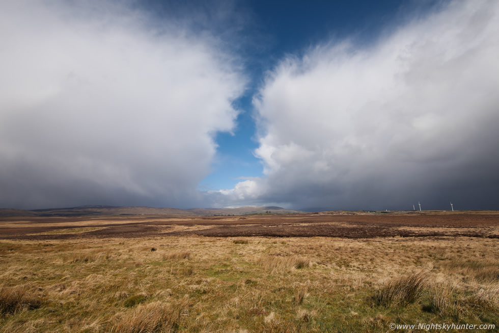 |
By late morning we where on the road, on some instinct I just headed to Lough Fea and took the exposed country road on the west side which offered a great view of the Sperrins which were all covered in a dusting of snow. I saw convection approaching and pulled over and got the drone out, man was it windy!, it must have been averaging 20mph but gusting in the high end of 30mph, especially when near any showers which were quite brutal to be exposed to. I got the drone in the air but the wind sucked the life from the battery and even in sports mode the drone was tilted at an uncomfortable 45 degree angle, it held position but it was risky and bouncing around all over the place so I decided I would use the DSLR from now on.
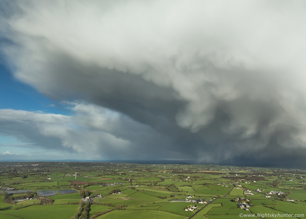
I took the scenic back road, it's not very wide, but I managed to get pulled over for a while to sky watch, the van was rocking constantly in the strong wind and Ella was starring out the windows with tremendous excitement wondering what was going on. I spotted two developing large hail cells to the NW, they were low topped but strongly sheared so I made the most of it and got out into the buffeting wind to get images, this is 15mm wide angle. It was actually a nice scene with the white showers contrasting with the orange and brown heather and bog land. The cell on the right would by pass me to the E however the one on the left was heading directly for us, I could see hail curtains falling across the landscape and getting close, I went back to the van to get shelter.
 |
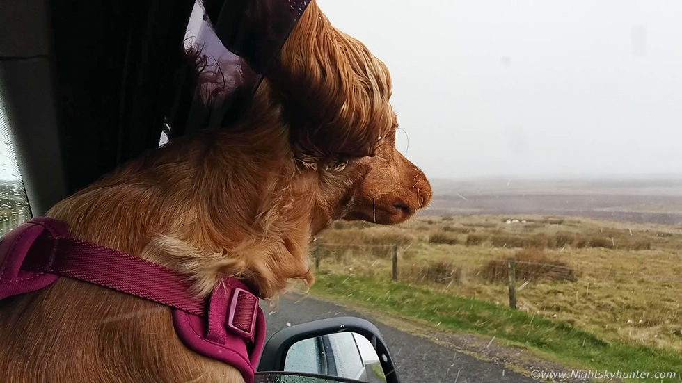
Window down, Ella looking out then standing on my lap starring outside, I was filming a vlog with the old phone just to get used to doing all this again and blow off the cobwebs so to speak. Phone snap of a nasty hail core rapidly moving our way, hail stones already falling through the air well ahead of it and coming into the van hitting Ella in the face, she was very curious about the whole thing.
 |
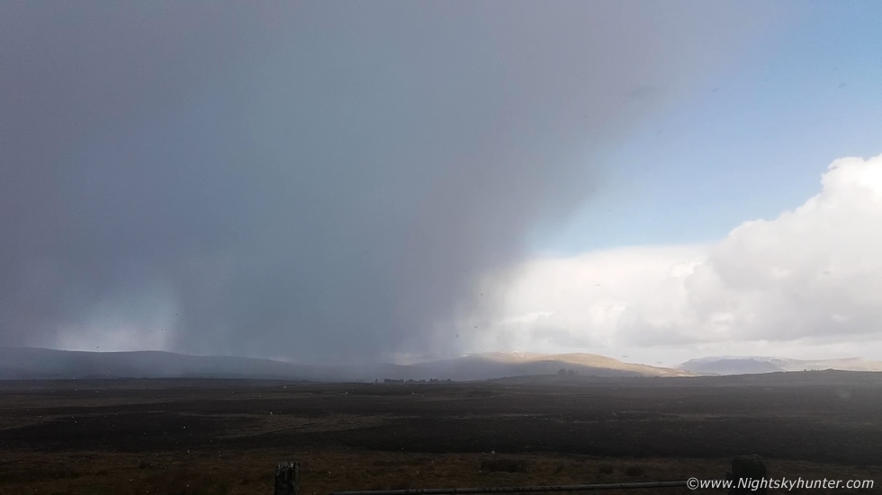
Full onslaught of wind driven hail literally blowing hailstones sideways across the road and into the van and over the seats. Ella seemed to be in her element, this was a good introduction, strong outflow winds blowing her ears back. I had to put the windows back up as it was getting too nasty but it was a fun experience for us both. The hail was small but very dry and well formed like packaging material, and very cold, when it hit our faces it was sore I can tell you. Once it passed we drove on and walked through a forest in the middle of nowhere then by early afternoon I drove back to our previous position only this time near the junction adjacent to the lough.
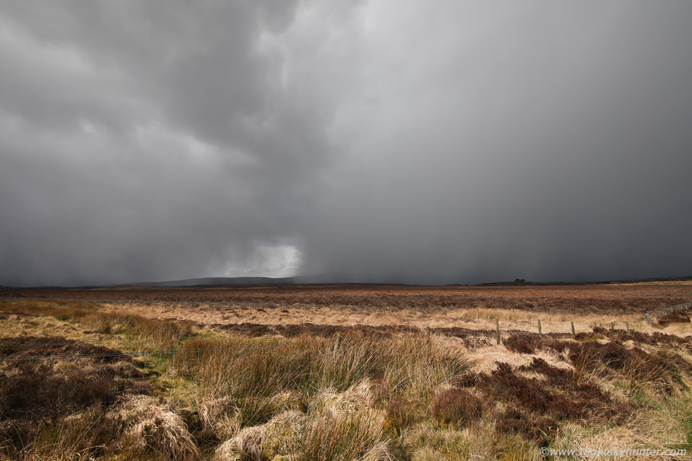 |
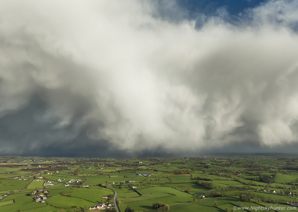
Big hail core blowing in across the heather, a pocket of sunshine lit up the foreground making for nice contrast, 15mm wide angle on the full frame again, these were big cores.
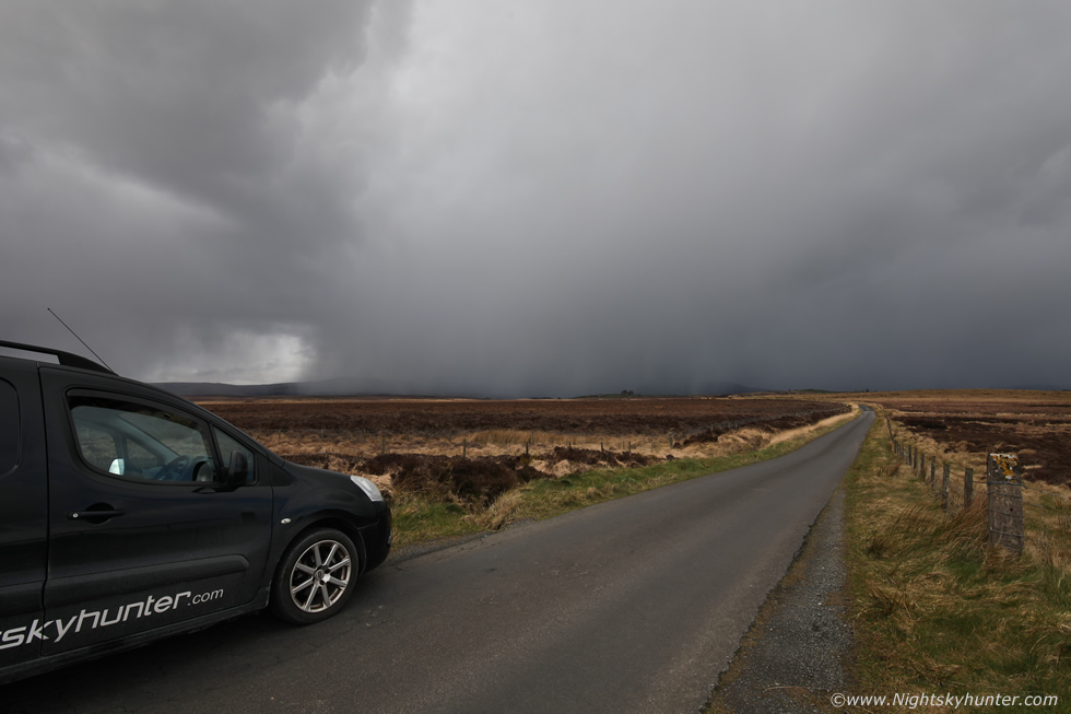 |
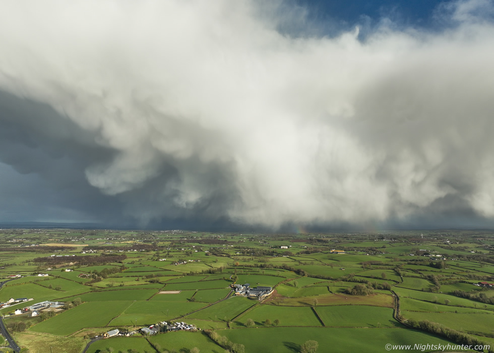
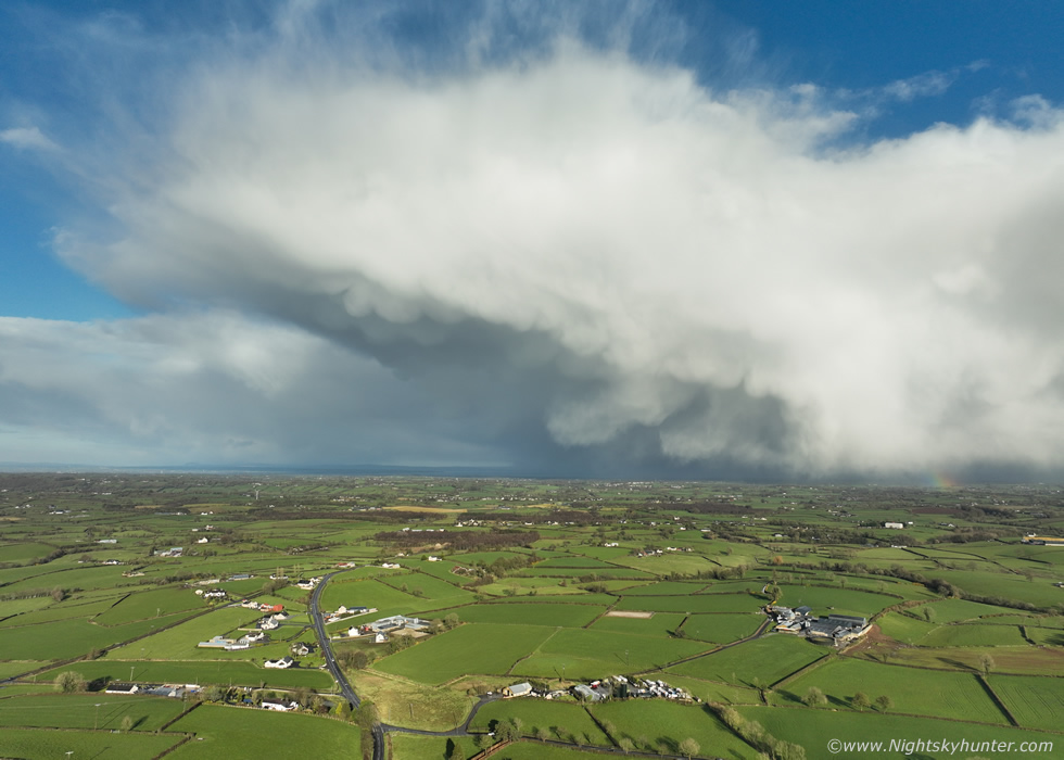
I had to get the van in the shot for a sense of scale, I should have washed it first. Wind mental outside, camera getting buffeted, this was a very exposed area with nothing to stop the wind, 30mph or stronger horizontal hail is nasty, the wind chill just takes it out of you if your getting hit for long in that. Secretly I was enjoying it all, it felt great to be experiencing actual convective weather again and to be on the hunt once more. I made a mental note of this location and decided to try it again during the Summer, a big multicell storm would look nice over this terrain, especially when the heather comes out in rich colours then. Turned out around this time there were two thunderstorms, one to the SE in Co. Down and another with a cluster of c-gs to the NE over the Antrim/Ballymena area, I got a visual on the latter cell which looked big and solid. I headed home as the CAPE eased but there would be another chance two days later so I would keep an eye out then.
March 27th was a very similar set up only with slightly warmer tops at -20c, a Wly flow this time, similar instability and strong low level shear. Another day of hail showers and a low risk of thunder. I kept an eye on the sky on and off all day, there were plenty of passing hail showers but the cells didn't look that impressive to be honest so I had more or less gave up hope of anything interesting to capture on camera. Roisin and I had just returned from a day out and it was late evening when I saw a cell on radar approaching Cookstown from the W, outside it just looked like a dark sky with hail curtains, it hit battering the windows with wind driven hail, it made quite a noise as it passed. My dinner was literally ready, just taken out from the oven, I was starving and had been looking forward to it all day, then I looked out the back window and witnessed a great looking sky. The hail cell had just passed over and I was now looking at the rear (flank) end as the hail cleared and the sun came out to light the whole thing brilliant white. To the SE I could see a big slope of hail falling and some beefy structure and an anvil, I forgot all about dinner and got the drone in the air as quick as I could.
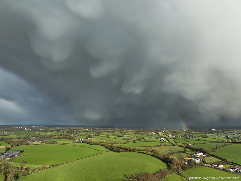 |
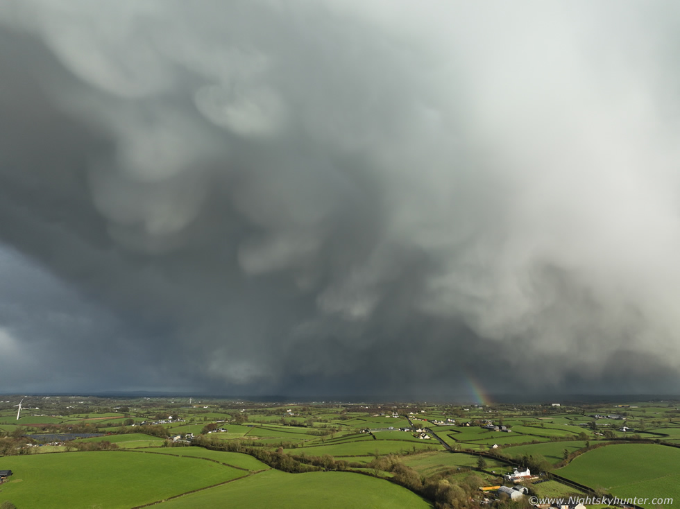
Once the drone cleared the trees I was shocked by the sight, this was the N sector of the vast cell and the sky was filled with huge mammatus pouches. The wind was still howling and the drone was still settling, I hadn't locked on to that many satellites yet but I began shooting anyway as strong wind warnings appeared on the screen. Full wide angle with mammatus and segment of bow facing E. I frantically began shooting video sequences and stills trying to make the most of the opportunity as the cell was moving E fast.
 |
Panning drone a little more to the N (left), you can actually see the slopes from three anvils lined up one behind the other from what looked like a cluster on radar.
 |
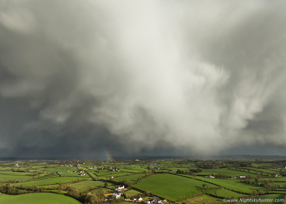
Panning a little more N to get the clear blue skies with the scene, that's the Cookstown cream factory to the lower left. These were the biggest mammatus pouches I had seen in years. Some of these 'udders' can be more than one mile across, they are also very high up, much higher than they look, they are formed by sinking air and other complicated processes however their exact mechanism isn't fully understood yet.
 |
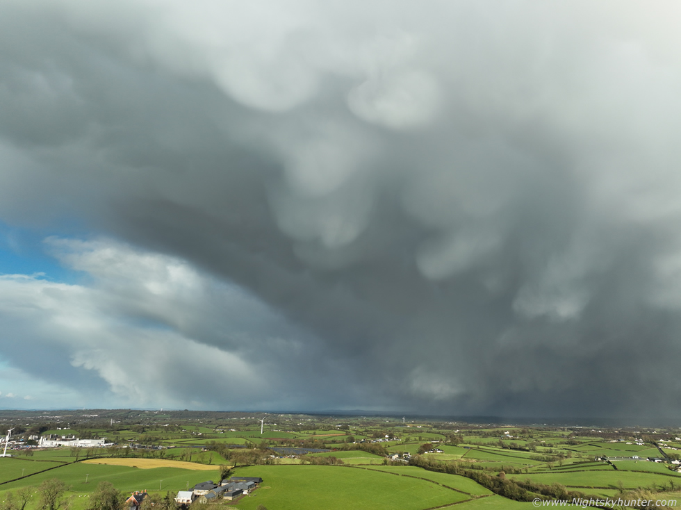
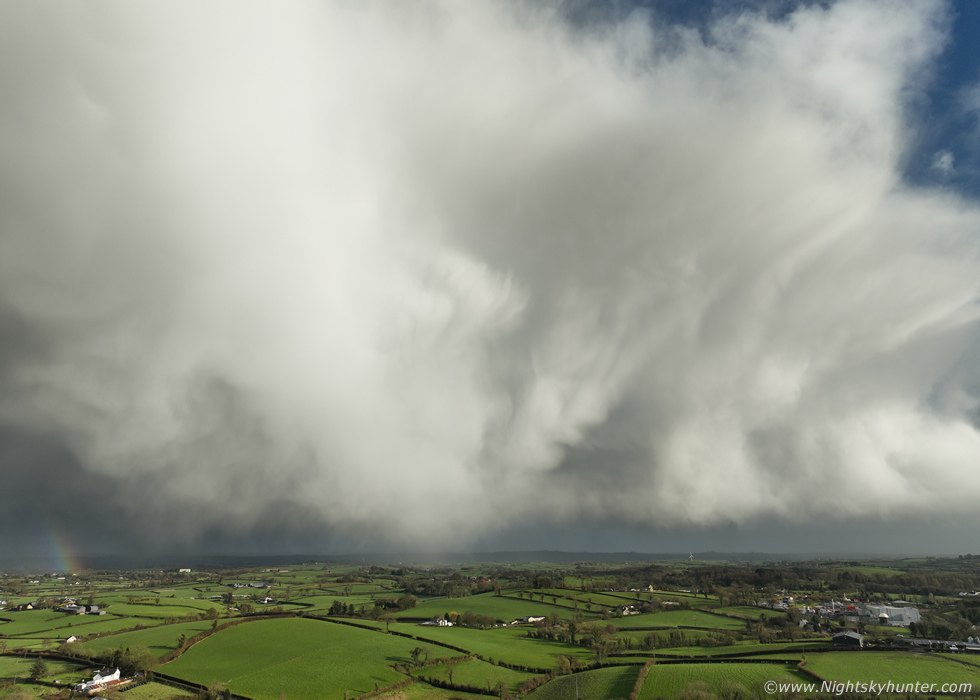
Back to centre left, this is only part of the cell which extended far beyond the frame to the right. I can honestly say these are the most dramatic skies I've seen this year and definitely since September 2025. I was honestly buzzing from excitement, at last proper convective skies, the storm drought had come to an end in impressive fashion.
 |
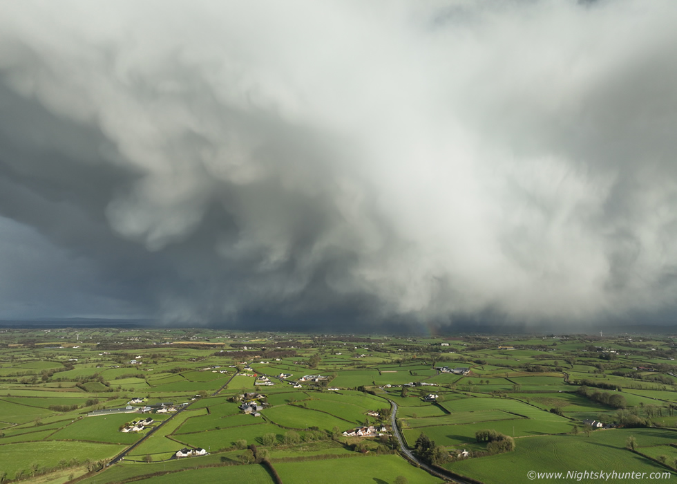
Centre of the cell looking due E, think of it as a mountain of ice crystals and water vapor collapsing and sinking through the atmosphere and sculpted by strong winds. This was a high dynamic range scene, that bright sector was a big curtain of hail strongly lit by the sun while the gaps in the mammatus where in shadow, the drone almost blew out the image.
 |
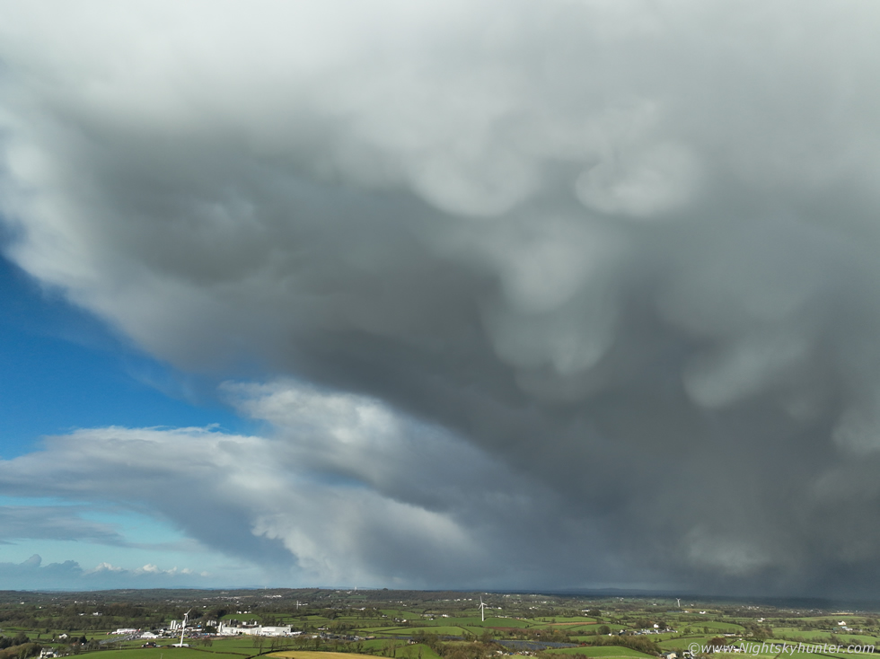
Centre right looking SE as new mammatus began to form on the anvils on that side.
 |
The whole thing was a fair distance E now and not far from the W shore of Lough Neagh, I wish the wind hadn't been as strong to leave it around for a little longer, there wasn't much time to frame things up and think about filming, it was a pure spray and pray scenario.
 |
Anyone outside to the west and middle of the lough would have had a great view of those pouches rite now.
 |
Just a real crazy looking mean sky in bright sunshine almost hugging the ground. This is why I never take my eyes off the skies on convective days, anytime you have a day of big showers and/or thunderstorms forecast always wait for the precip to pass and visually monitor the back end of any cells for surprises, it's here where rainbows, dramatic clouds, rain and hail cores, mammatus, flanking towers, anvils, bases and even where funnel clouds and tornadoes can be spotted.
 |
I couldn't have been in the air for more than ten minutes and the cell was away to the E and getting further away but it was fantastic while it lasted.
 |
Final capture before turning the drone around and flying home into the strong Wly head wind. You know what was interesting, the radar signature from this wasn't very impressive, no reds, all blues and greens, it was a decaying cluster of hail, there were better cells around yet none of them looked as impressive as this one did. This goes to show that radar can be deceiving and to always check the sky visually for nature likes to throw surprises. This was a very fun evening which went beyond any of my expectations, finally some cool skies for Spring, new images and chance to update the website and get things back in action.
Vlog from March 25th in the Sperrins with Ella and the hail, really just messing about and enjoying nature.
Drone footage of the March 27th hail cell departure with mammatus pouches captured in strong winds an hour and a half before sunset, I hope you enjoy the footage. I'm now fully locked into Spring and looking forward to more chases soon, it's time to hit the road in pursuit of thunder and photogenic skies. If anything cool does happen I will be doing another report on here so keep an eye on the website for updates, thanks very much for reading.
Martin McKenna
