
|
|
 |
April 15th 2026 was the first proper storm set-up of early Spring when warm moist air advected across Ireland behind a cold front and ahead of a trough with -30c upper cool pool and 600 to 800j/kg of CAPE with enough shear for multicell clusters. I spent the day chasing in Co. Tyrone where models indicated the best chance of storms however it was a challenging day with constant driving E to W and W to E with little to show for it. I finally got a respectable gust front on a cluster E of Omagh. I then drove E to seek strong heating at Lough Neagh and upon arrival got treated to my first storm of the season at Ballyronan Marina with a nice sunlit flanking area over the lough itself. This was my first thunder in seven months and it was worth the wait, the new season is now underway. One page report with 15 images and one video vlog. - REPORT.
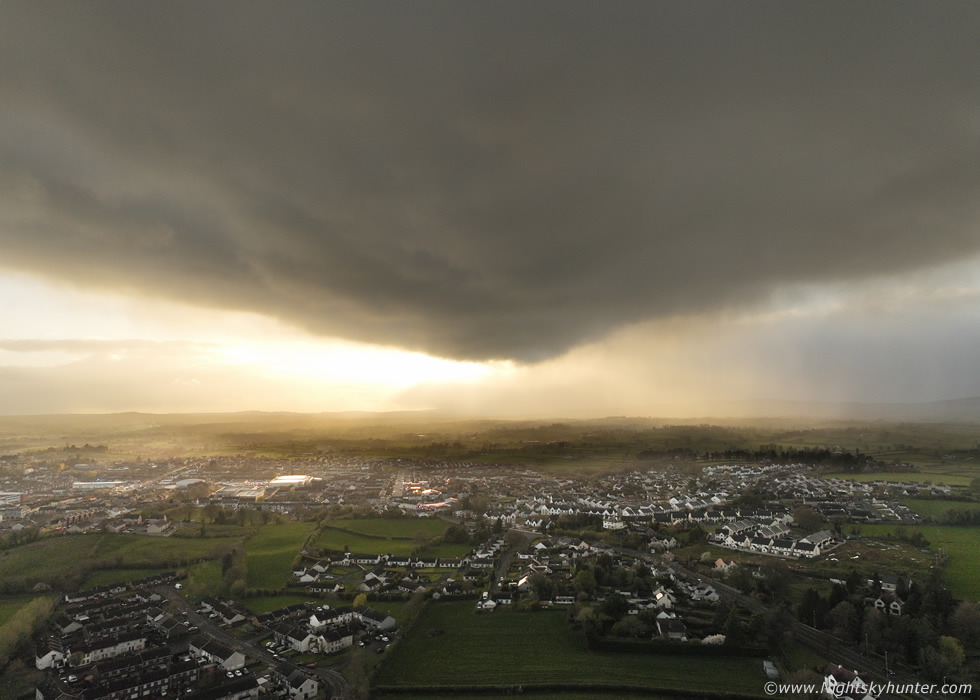 |
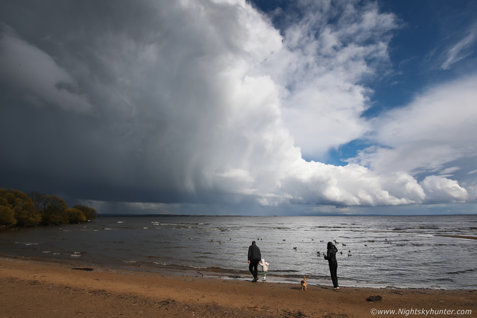
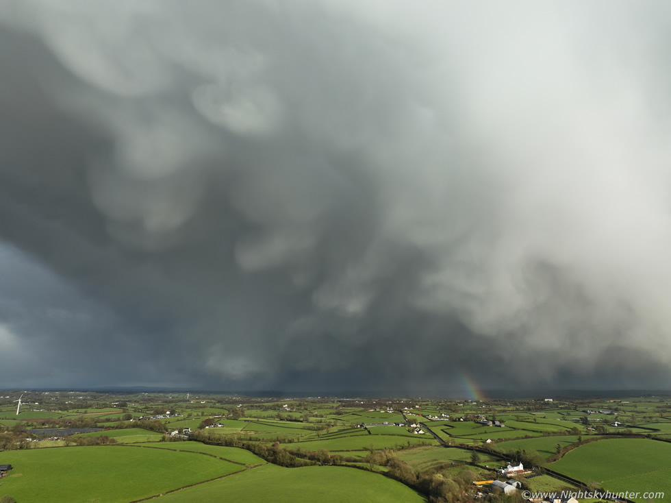
A classic period of 'April showers' dominated the pattern for early Spring thanks to a cool pool aloft and low end CAPE however all balanced by exceptionally strong wind shear. Easter 2026 was a day of wintry showers with a chance of thunder. A cell passed over bringing blowing hailstones and wet snow to Cookstown and as it cleared it presented a nice sunlit anvil with mammatus over the countryside. On April 8th a chase day in the Sperrins yielded little however when I arrived home before sunset a dramatic strongly sheared rain free updraught base appeared in the west back-lit by the sun with structure I had never seen before in any April. The cell made for an unexpected impressive sight before intense rainfall ended the show. One page report with 6 images. - REPORT.
 |
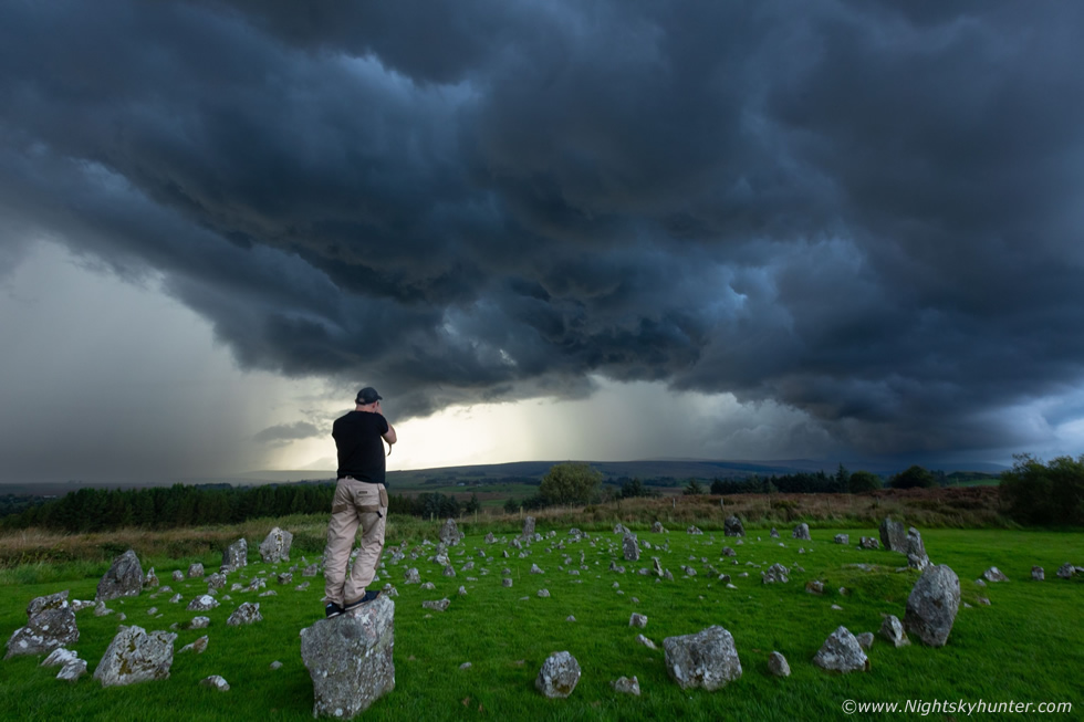
After a long drought of photo opportunities things finally turned around during late March when a cold unstable air mass with strong wind shear brought back to back days of convective hail showers and even a few thunderstorms across N. Ireland. I did a local chase in the Sperrins on the 25th encountering nasty horizontal hailstones in 30mph gusts however it was on the 27th when the tables finally turned. A late evening cluster of hail cores passed over Cookstown and in the clearance where the sun broke out the cell's flank sported dripping hail and a formation of impressive mammatus pouches under a brilliant white anvil. I got the drone in the air for a look while battling strong gusts of wind, this turned out to be my first 'cool skies' of 2026. One page report with 16 images and two videos. - REPORT.
 |
I haven't updated the website in a while so I thought I would do so now to fill you all in on what's been happening. To be honest the only reason you haven't seen any updates on here is because there has been nothing exceptional happening since my first snow adventure of the year (below) and despite being out on a few low key local shoots and various drone filming sessions at the coast I haven't experienced any night sky or weather event worthy of posting on the site. The sky has been fairly quiet, except for recent G2-G3 auroras which were badly impacted by thick haze so I didn't shoot these. As it stands I'm simply just waiting for something exciting to happen that peaks my interests. It's currently early Spring and I have welcomed the longer days and very much looking forward to storm chasing and NLCs on the months ahead including any other unexpected night shoots.
I look forward to tracking down a comet during April called C/2025 R3 PanSTARRS which could become a binocular or even naked eye object in the morning sky within Pegasus around mid month however it will be approaching morning twilight and remain low in the sky, as it stands it will be our brightest comet of the year in the north unless a new object is discovered in the future. Speaking of comets, Hyakutake was at is best during March 25th 1996 near Polaris with a naked eye gas tail 80 to 100 degrees long!!!, and in March 1976 comet WEST put on perhaps the best show in modern times pre-dawn with a sweeping curved dust tail with synchronic bands which stunned star gazers in the northern hemisphere. It's hard to believe our last great comet was Hale-Bopp in 1997 some 30 years ago and we are still waiting for the next one, I hope our long wait will be over soon and the best has yet to come.
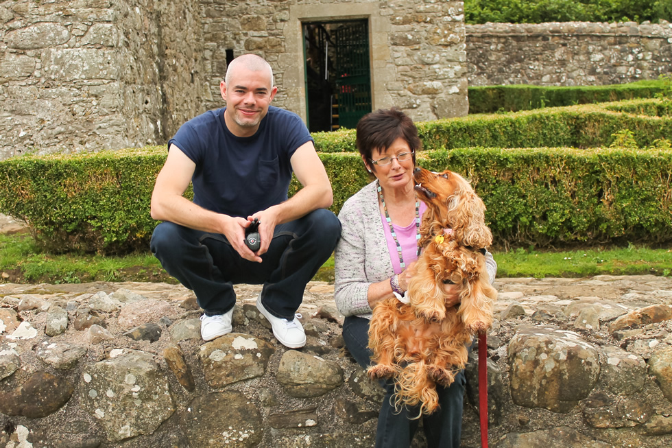 |
(Above), Rhua, Mum and I many years ago at Monea Castle in Co. Fermanagh.
In other news our dog Rhua (14) passed away during January, she had to be put to sleep due to her rapidly declining health so we had to do the rite thing so she could have a peaceful passing. Rhua was like a best friend to me during those 14 years, she was with me almost every night and day during good times and bad, she was my partner during all night long shoots under auroras and NLCs and she was with me for nearly all my storm chases and drone filming sessions. To Roisin and I she was like our baby girl. When Rhua passed I was completely devastated, it was the worst loss and emotional sadness I have ever felt and it affected me deeply. I have never really got over it and don't think I ever will, the experience has changed me in some ways.
However through pure random coincidence, or perhaps spiritual intervention, we have a new dog, also an English Cocker Spaniel, called Ella. Ella is 9 months old and needed re-homed quickly and for some reason we were selected from 40 applicants to have her and here we are. Ella is amazing and has healed our hearts alot and brought joy back into our lives. We look forward to bringing her up into a new exciting and wonderful life, and she will be accompanying me on my future photo shoots, we will give her a great life to honor Rhua.
I've been doing a lot of public talks/presentations recently over the last couple of years. I recently done one in Derry/Londonderry and last year I did a big one at Queens University, including many talks for the National Trust. I have more lined up for clubs/groups in 2026 in Bangor, Derry and Glenarm to name but a few and will likely have more venues added soon. These talks vary from the night sky in a particular month to talks on telescopes, meteors, the aurora, and even thunderstorms. My most recent in Queens was a talk about comets and my life (title cover above), in this presentation I discuss how I got into the night sky, my Hale-Bopp encounter, an insight into my ten years of comet hunting and close calls, recent NLC and aurora events which have impressed me and even how I got into storms. The talk was well received and I have been invited to repeat it again at other venues. If you would like me to give a talk at your club or for any social event, then please let me know.
I would like to congratulate my mate Conor McDonald on getting married to Emily. Roisin and I attended their great wedding. Conor and I have done a tremendous amount of observing together over the years and it was he who got me into storms and storm chasing so we go back a long way. I'm delighted to see him with such a special women as Emily. May the stars always shine on their lives.
I have been contemplating writing a book about my life under the stars, several people keep suggesting I do it, however I haven't typed a single word of it yet but I'm just putting it out to the universe at the minute to see how I feel about it. If I do decide to commit to the project the book would be about my life and feature segments about auroras, nlcs, telescopes, and my storm on photography and storm chasing along with educational sections on these phenomena, that's the basic plan anyway. If you think I should start on a book please let me know.
That's about it for an update for now, hopefully next time I update I will have plenty of new images to share. Thanks very much for reading.
Martin
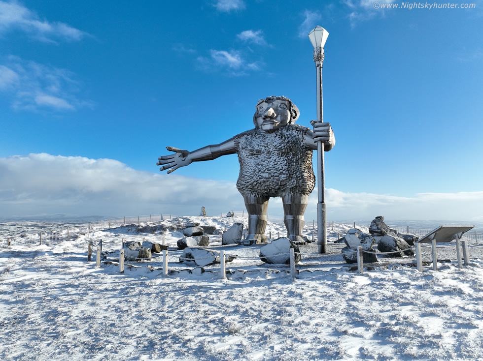 |
It's a brand new year and with it came a five day cold spell thanks to deep Arctic air and Nly flow which brought numerous snow showers across N. Ireland throughout the period. We had snow on the hills every day and at least three days of laying snow at low levels. I wanted to do something different and get 2026 off to a good start so we hiked through Gortin Glen Forest Park outside Omagh on a 7.6km round trip, half of it uphill, and captured the famous Sperrins giant 'Darach' covered in snow and obtained our first ever winter footage of this famous area. This was a great hike, surrounded by snow, crisp clean air, good exercise and a lot of fun. One page report with 26 images and 1 video vlog. - REPORT.
 |
Astronomy is not the only subject I'm interested in, check out my N. Ireland Storm Chasing section and view the chase reports and images which detail not only storms but other phenomena such as a moonbows, noctilucent clouds, aurora displays and exciting nature related photo shoots.
Martin McKenna
Home