

|
|
It was Wednesday June 27th and the sweat was running down my face, I was standing in the beautiful countryside to the N of Maghera looking across the colourful lush fields towards a brewing storm while the sun cooked the ground. I hadn't felt such strong sunlight and humidity like this in years while waiting on thunderstorms to break out and all I did was walk a few 100m from my home. This was to be one of two big storm days thanks to a combination of ingredients in the form of humid unstable warm air from Europe clashing with cold upper air from an Atlantic low pressure system out W which would cause major thunderstorm development with a high risk of elevated 'Spanish Plume' type storms and surface based homegrown storms for the next 24-36 hours. Nocturnal thunderstorms where expected across Ireland during the night however before all this a clearing rain band in the morning left a very unstable atmosphere in its wake with 1000+ CAPE available, what surprised me however was the Met Office forecast which went for a mainly dry evening with just a few light showers. This forecast shocked me considering just how unstable the atmosphere was and in the hours to come I'm pretty sure they regretted those words.
 |
The day began with a lot of cloud cover which was perhaps why the Met Office thought storms were unlikely however by early afternoon it rapidly became very warm and humid with regular breaks in the clouds and it wasn't long before I was doing my usual routine of checking the radar and the visual sky every few min's for signs of development. It wasn't long before mid level towers appeared however as they tried to rise they hit an obvious capping inversion which stopped their vertical growth with the result being that the cloud tops just rolled over on themselves like an ocean wave. I knew that if is this cap could break then we could get some quite potent storms and I was ready for them with the intention of chasing all afternoon. I had the car all morning and evening onwards however during the important 1.5 hours in the late afternoon when it was away storms broke out which left me grounded at home, the timing was typical. Once a temp of 23 C was reached the cap had broke and towering cumulus clouds began to form with purpose and to my benefit they seemed to be over my home area, I even got a text from chaser Paul Martin who could see the towers over the Sperrins all the way from Omagh.
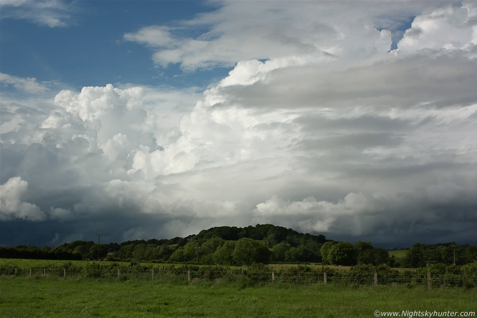
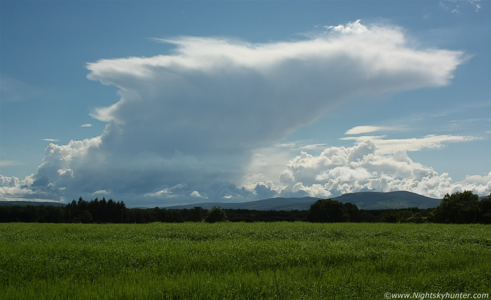
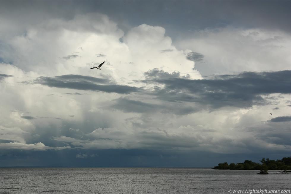
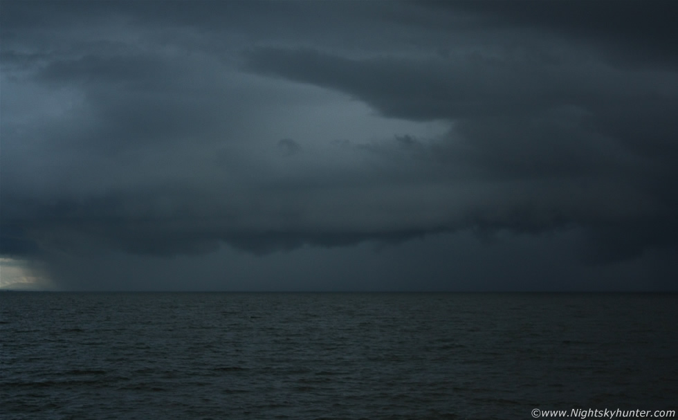
Before 17.00 a sudden surge of convection produced a wonderful looking line of towering cumulus clouds extending across the entire NW to NE skyline and as I watched from my back garden I could see updraughts exploding skyward so I grabbed my camera and a bottle of water and walked out the road for a look. So here I was sweating in the heat watching what was now a high precipitation multicell thunderstorm which appeared from nothing in such a short period of time, it was located a few miles away but I couldn't chase it without a car so I had to enjoy the sight from here. The above image shows half of that line of cells with crisp updraughts and cb calvus towers all lit beautifully by the sun, the entire line had an impressive low level dark base with complex scud/outflow cloud practically touching the ground. The towers looked wonderful above the green sunlit fields below as they slowly drifted from L to R (SW to NE) across the blue sky. The dark base to the L was where a cluster of c-g lightning was striking to the NW of Maghera and the dark base to the R (which continued far out of frame) was the source of a very active battery of lightning which affected Garvagh, Coleraine, and the Antrim coastline with the radar showing strong red echoes from both locations.
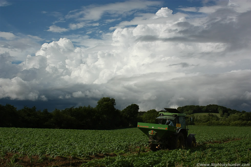 |
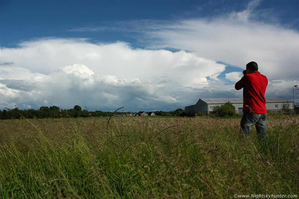
Here's the flanking region of the same multicell now quite a few miles away to the NE, I would love to have been closer to the base to watch for funnel clouds however I felt happy and content enough standing here in the lovely sunshine watching the storm structure from a distance. The farmers were taking full advantage of the hot day before heavy rain arrived later that night and the following day so they were busy in the fields doing their work. Towers continued to go up and soon the E/SE skyline had a row of storms in view but by the time the car came back it was too late to chase them so I stayed at home to monitor the radar. At 20.00 a tremendous slow moving shower dumped a lot of water over Maghera, it was quite something, I hadn't seen the like of it for many months and within min's the back garden was flooded. Our new puppy Dog 'Rua' had never seen proper rain before and she absolutely loved it and was jumping into the puddles like a lunatic which was funny to watch. What wasn't funny however was the flooding which happened over Antrim where slow moving multicells produced hours of torrential rainfall which soon made it onto the national news for several days. Streets and homes were flooded with south Belfast worse affected, there was even a car floating in the road and a police van trapped in the water with officers standing on the roof waiting for rescue. Some folk even resorted to navigating the streets in canoes and surfboards which made for some dramatic scenes on the news.
The real excitement was reserved for that night and the following day. ESTOFEX issued a level one alert for Ireland and UK because of the risk of a Mesoscale Convective System (MCS) forming with a chance of supercells and tornadoes and before it affected Ireland and England during the early morning hours there was a risk of night storms across the country so I was on full alert during this time. My plan was to set my alarm for 04.00 and get up and drive out to shoot the storms moving N over the border and stay out all morning and chase all evening, I was already tired and knew I would get little sleep. The Met Office issued an amber warning for heavy thundery rain and more flooding so I envisioned a busy period of photography. I got up at 04.00 and all the action was in the Republic with plenty of lightning so I went back to bed and got up again at 05.00, more lightning but too far S and it looked like the big storm would cross the Irish Sea and hit England later in the morning however it looked like extremely heavy rain was heading for N. Ireland with bright widespread red echoes which wasn't electrified so I set my alarm once again for 0800 for another check because I needed some rest to keep me going later in the day. The real area of interest for me was the post frontal airmass which was extremely unstable with CAPE values between 1300-1500 and LIs of -5 with a series of troughs and enough wind shear for decent multicell storms. Sleep that night was impossible due to the excitement and anticipation of what I might see the next day, I felt like a child trying to sleep on Christmas Eve night. I didn't get any sleep at all, my eyes were closed but my mind was active and my adrenaline on a continuous slow release so I just shifted and turned in an unsettled fashion through the early morning hours and by 08.00 I was up and ready for the day.
 |
The forecast looked excellent however the morning was very cloudy and damp which had me concerned for a while. I spent the rest of the morning studying the charts, watching radar, sat images, and monitoring the chat/weather reports on facebook and Twitter. A new check on the sat loop showed clear breaks down S which would move N later so I was confident there would be storms for certain. I got a private message from Omagh storm chaser Paul Martin and soon we decided to meet up and go chasing together which is something we have always wanted to do. Soon Paul had hit the road and I knew it would take him just over an hour to get here so I rechecked all the models and tried to figure out what the atmosphere was going to do, my last radar check was a good omen because it showed thunderstorms breaking out below the border and they where heading NE so the timing was perfect. I hit the road myself half an hour later and soon got a text from Paul saying he was driving through heavy convective rainfall with thunder/lightning near Cookstown so the day got off to a good start. We had arranged to meet at Ballyronan Marina on the NW shore of Lough Neagh and even as I pulled into the car park I could hear thunder rumbling in the distance and getting louder by the min.
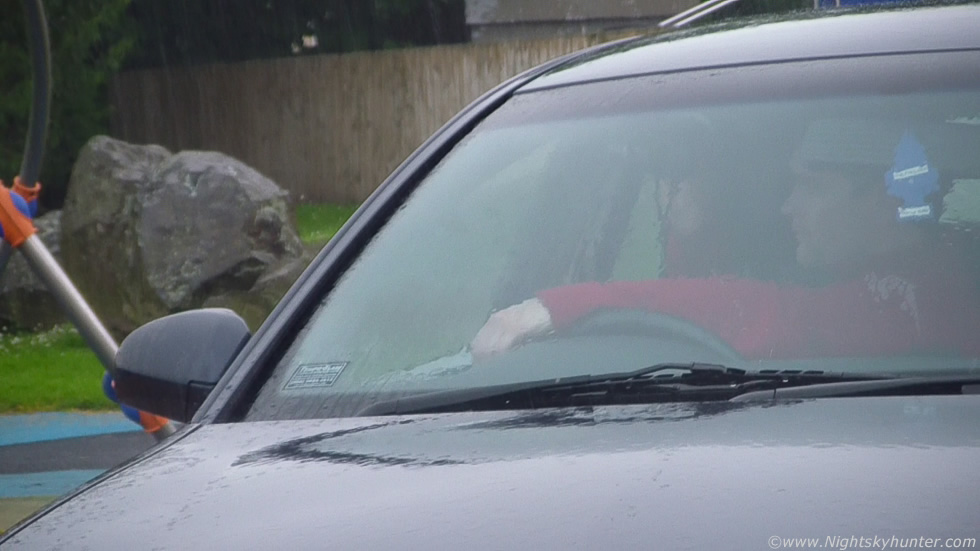
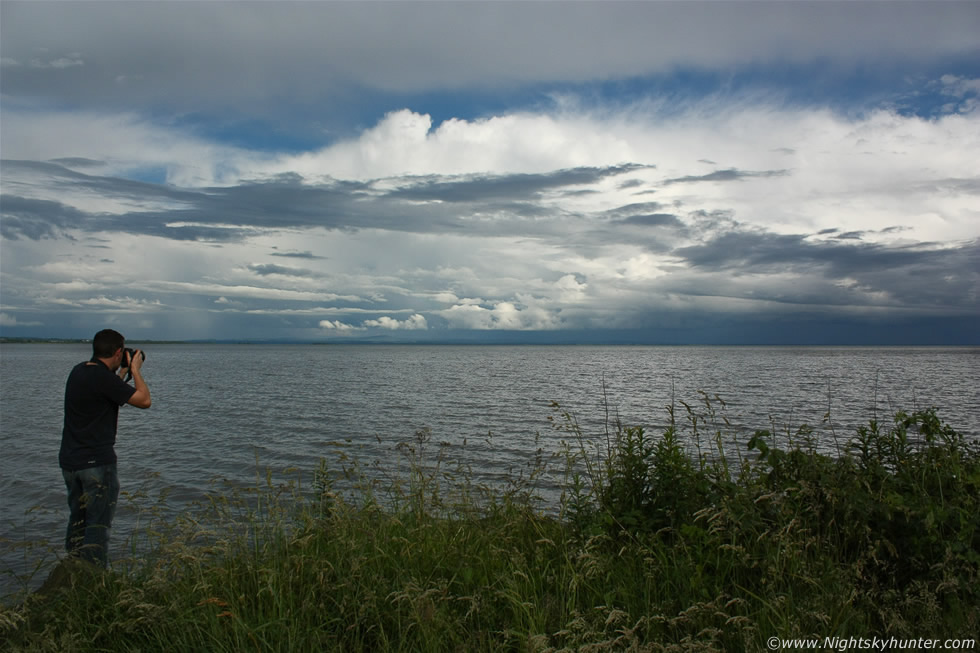
Paul arrived just as the storm did and soon the sky was rumbling randomly with flashes of lightning and heavy rain so we each stayed inside our own cars and parked close together, rolled down the drivers windows, and began taking video footage of the storm, it was far too wet outside to be setting up a camera and there really was no safer place to be than inside a car when there's lightning nearby. The above image is a grab taken from my video footage showing Paul concentrating intently on the sky with video camera pointing out the window. There was no visible structure to this storm and it was certainly elevated in nature so we just sat back enjoying the show, the storm was quite electrified and produced alot of lightning as it passed over Mid-Ulster and Lough Neagh and my legs got soaked as rain came in through the open window so I had to continually wipe the lens dry. Most of the lightning was embedded within the rain and high up within the clouds flashing over the lough although I did see a few nice i-c bolts whipping across a large area of sky overhead, one of these produced a very loud rumble of thunder and I could have sworn I felt the car shake slightly from the shock wave passage.
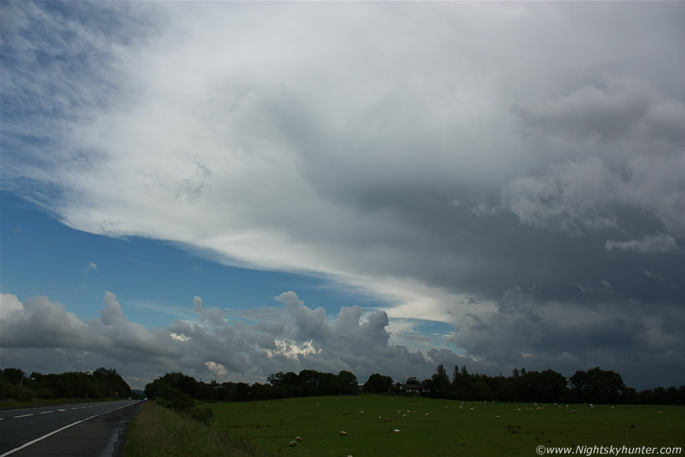 |
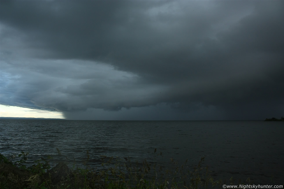
Once the storm passed we grabbed a coffee and a few bars of chocolate from the local shop to keep our energy levels high then decided to move location. I got a call from chaser Declan O'Doherty from Maghera reporting seeing big towers far S of Slieve Gallion heading N which was great help because internet coverage was not ideal in this area so we decided to head N for a better signal, we found one on the carriageway and saw a big line of storms stretching across much of the country heading NE and sure enough we could see the top of the storm from the road so we drove on in search of a better vantage point. We parked on the shoulder adjacent to the main Glenshane Road and got out to watch the storm approach, it was very big and dark blue in colour with rows of nice convection getting pushed ahead of it so we stayed here where we had a good horizon and watched it slowly approach, we were hoping for a stunning shelf cloud however once the dark base was glimpsed it seemed the line was devoid of interesting structure. We watched and waited, the N side of the line had lighter precip and that was the section that was moving towards us, the S side looked much darker and it was there where the strongest precip cores where located so we stayed for a while deciding what to do. The above image shows the leading edge of the anvil on that huge storm moving from R to L which was once again dropping heavy rain and lightning over the Lough and Antrim. We decided to let it go because we where already under a storm earlier and aside from lightning there's nothing to shoot so we decided instead to stay further back in search of structure shots and funnel clouds.
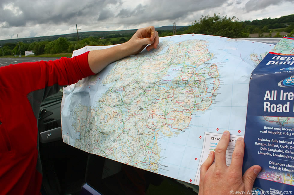 |
The chase plan was a little difficult so we had to make some important decisions. We checked out the map for potential chase areas and future storm positions, the television forecast was going for storms over W and E areas with central regions staying storm-free, we where stuck in the middle and needed to make some good decisions. The sky looked lame at this point with no decent convection in sight so we began to get worried, we needed to see the bigger picture via radar so we drove into the Maghera countryside and put our heads together. The new game plan was to head back to the lough incase we got a funnel or waterspout as the radar showed more cells moving into that general direction so off we went again.
 |
We had just left Maghera approaching the E-W junction onto the Glenshane Road when we spotted a beautiful cell to the SW so we briefly abandoned our E plan and parked up to get a few images. The cell looked much better before we got stopped with a very sold straight back edge on it however it still looked great over the green fields near Glenshane. Radar confirmed this was a thunderstorm over Omagh so it was some 40+ miles away from our location so must have been pretty massive indeed, the sheared anvil looked really impressive blowing downrange in the direction of the storm's forward movement (L to R) so this storm was probably organized for a brief period and radar showed an interesting hook feature associated with it too, probably not a true hook of sorts but interesting enough to suggest some large scale rotation could have been happening under it, ironically this storm was over Paul's home area!. There where several impressive cells in this region which almost had us changing our plans and head W towards Derry and wait for those cells to move towards us however the chances were good they would not survive for that length of time, also check out the anvil on the Omagh cell, beforehand it was solid but now a very wispy affair indicating weakening updraughts which meant the storm was dying so we got back on the road and headed E as we originally intended.
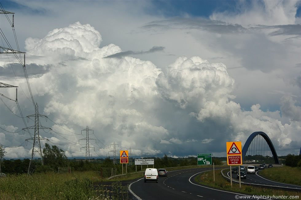 |
Ballyronan Marina was our destination but the skies looked so interesting to the E that I got distracted and missed the turn off so we continued on for a while then pulled over outside Toome near the famous bridge to shoot the incredible convection which was covering the entire skyline from the SE to NE with big cells, anvils, and towers peaking at their finest during prime heating time. This is what you call truly explosive convection, just check out those massive updraughts miles away over Antrim with boiling towers like atomic bombs, this is what 1300 CAPE and a lifted index of -5 can do!. The entire scene looked awesome as we drove E with the cells looking like solid white mountains above the sunlit fields on the other side of the River Bann but we couldn't get pulled over anywhere for a decent shot, this image was taken during a very quick pit stop in an area where parking was not allowed so we had to be quick with the camera. That rain free updraught base to the R of centre looked very interesting with lots of lowerings including a feature which looks a little like a funnel cloud under the base although it was too far away to be sure, I found out later that a funnel cloud was observed and photographed over Antrim around this time so I'm quite certain that this cell was likely the culprit.
 |
Now on the other side of Toome bridge where we pulled over yet again to shoot the cells, this time we found a very nice field and went inside to document the big anvils in that direction. Antrim looked to be a getting a pounding for the second day in a row with more torrential downpours and lightning, some of the homes near my girlfriend's house were struck by lightning and one even had the phone socket blown off the wall, I later saw the black smoke damage on the wall for myself. Here's Paul in action shooting a big storm 10-15 miles away to the E which had a nice solid anvil towards the rear of the cell, this was behind the other convection in the previous image.
 |
We finally got to Ballyronan Marina for the second time this day and on the road down we saw a gorgeous line of cells on the far side of the water which looked capable of funnel clouds and waterspouts but by the time we arrived at the shore the cells had moved away to the E quite some distance from us, here's one of these cells taken at 55mm, many more where lined up in front and behind it in a train and more could be seen further away behind these. It was surreal taking images of these storms from this distance under bright sunlight with Gulls swooping through the air and Ducks quaking peacefully on the water beside us.
 |
We moved on around the shore to a quiet location and enjoyed standing on the rocks while watching the distant convection, the warm sun and the sound of the water made for a peaceful atmosphere. It was clear from the view to the E that the cells where getting further away and weakening so it seemed our day was over, one last check on the radar showed a cell far below the border which might arrive over the Lough in a few hours time however the odds were high it would die out before getting this far N so we decided to call it a day and head home. Paul and I had a great time and got treated to a few nice storms and pleasing skies which made the day worthwhile, we always seem to catch something when we meet up, either storms or auroras.
I drove back home to Maghera feeling content with the day but before I ended the chase I stopped in the countryside to watch for funnels from bases overhead when I reached into the back seat for my camera bag and realised it wasn't there!, maybe I was getting dehydrated and not thinking clearly so I checked again under all the coats and behind the seats but it was nowhere to be seen, then it dawned on me - I had left my entire camera bag behind at Ballyronan Marina!!!, and I was quite sure I left it on the ground in the car park before I drove off, I had a number of bags with me at the time so I probably assumed I had it with me, and now it was sitting in plain view out in the car park in front of everyone and that was half an hour ago, I knew the odds were remote it would still be there, there are not that many good people out there who would not steal my gear, anyone lucky enough to have picked it up would have a free Canon 450D with spare batteries, memory cards, remote shutters, cable releases, a Canon 50mm F/1.8 lens and full HD video camera. My heart sank to think that all my gear was likely gone and all the images I took from this day would be gone too, I felt such an idiot then angry at myself and the universe because of this complication I didn't need so without thinking I started the drive back to Ballyronan Marina at a higher speed in the hope of a miracle happening.
Not believing what I had done I pulled over again and did another check, even in the boot, but this only underscored the reality of what happened. I drove S in a state of high anxiety, I knew by the time I got there the bag would have been sitting in plain sight for nearly one hour so I had to assume it was gone however the optimistic part of me wouldn't give up and something told me to keep driving so I trusted my instincts. The thought of having no camera had never crossed my mind before and yet here I was facing this prospect, how could I feel motivated to go storm chasing or aurora hunting again without a camera?, seeing these things is one thing - and I have spent countless years doing that - but catching them on camera is something else entirely, this is were my passion was so having no camera was completely unacceptable. I contemplated how I would get the money I needed to replace the camera as quickly as possible and what sky action I would miss while I waited for it to arrive, I could actually feel my skull crushing against my brain as I stressed over these issues then I got a grip on myself and calmed down and just learned to deal with the worst case scenario and besides, it wasn't lost yet, at least not until I could confirm it.
Just as I approached the crossroads at Ballyronan I saw brutal looking black skies moving in from the SW over the fields and heading for the lough with very solid clouds close to the ground with chaotic motions going on, typical I thought, here was a storm heading straight for me and it even looked capable of a big funnel and I had no camera gear at all. I entered the car park with my heart in my mouth and I could instantly see the bag was gone..sigh..I walked into the building hoping some good citizen had found it and left it in or at least had a note on the wall about contact details on how to collect it but nothing. I went back outside again and saw a group of swimmers come ashore and I thought about asking them but decided against it and had one last search. I walked out to the area where Paul and I stood earlier (above image) and walked off the path onto the grass beside the rocks and sure enough there it was sitting unharmed hidden from sight in the long grass, I was beside myself with happiness and relief, I said ''yessss'' out loud and held my fist in the air saying ''thank you universe'', had the bag been on the path it would have been stolen but the fact that it was hidden in the grass was beyond fortunate. I really did sense a higher purpose at work and I wondered what was the reason for all this, after all this was my third trip to the lough this day, then I knew why I was here.
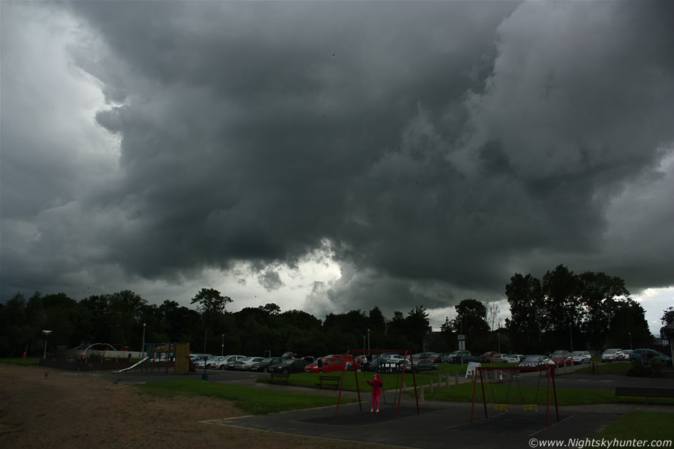 |
The universe had caused all this turmoil to re-direct me back to the marina to catch one last thunderstorm and had I not lost my camera bag I would never have been here in time to catch it, it's funny how things work isn't it. This is the lough shore facing SW towards inland areas at heavy clouds ahead of the storm moving towards me, those clouds looked dramatic and were flirting with the idea of trying to produce a funnel, the outflow air from behind was agitating their movement a great deal. The actual thunderstorm itself was behind that line of trees, I could hear a distant rumble followed by more as the storm got closer. The young girl on the swings had no idea that she was at risk of getting hit by lightning.
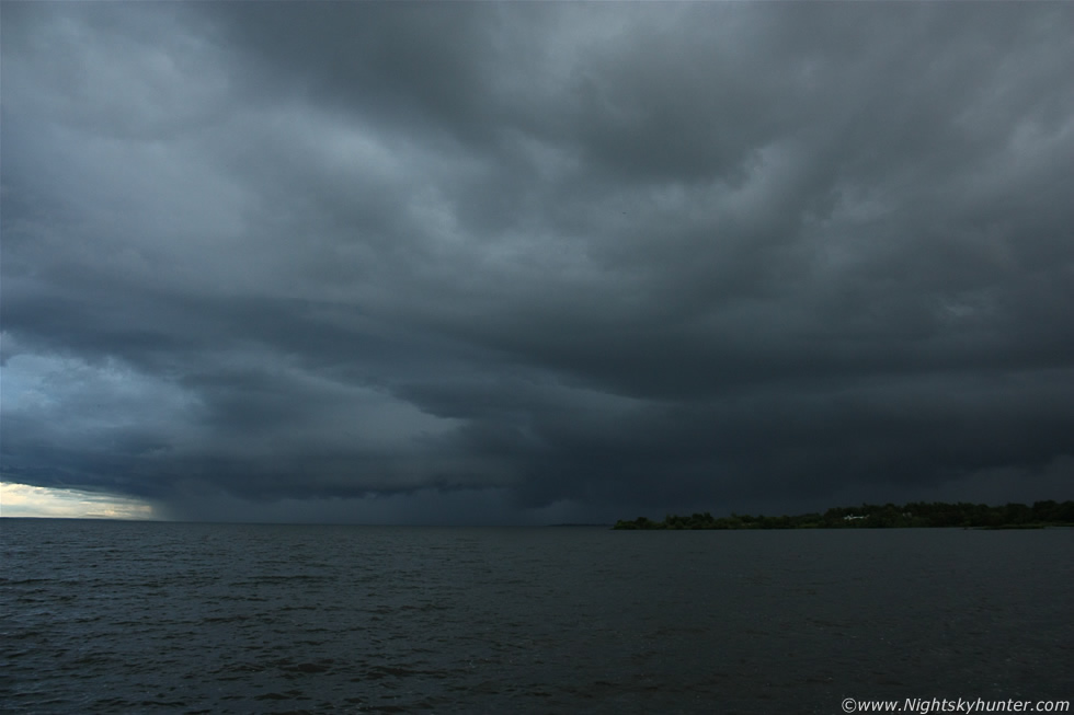 |
The multicell storm was now in full view and heading directly across the lough towards me, you can see the shelf cloud along the leading edge with half of the storm over water and the other half over land and extending out of frame to the R. This was the very cell Paul and I had been watching on radar earlier and assumed it would die before it got to the Lough and yet here it was looking great rumbling away angrily. I was sure this was what the universe wanted me to see, it almost felt like this storm was meant for me and me only, I set up my gear on the path near the edge where Paul and I had been earlier and began shooting images while trying to get some video footage at the same time, I didn't have long before the precip arrived and I could already feel the chilling breeze from the storm's outflow catching me from across the lough. Images don't do this storm justice because it was some of the blackest skies I have ever seen along with an eerie blue tone, I had to ISO up to 400 for this shot and as I experimented with settings a periodic flash of lightning would reveal itself under the shelf.
 |
Zoomed in a little, camera fixed to tripod, aperture stopped down with a slower shutter speed and correct ISO in conjunction with this dark sky presented me with the perfect conditions to try and catch daytime lightning. Just as I was looking through the viewfinder and getting focused for this vary image three rapid fire orange coloured bolts hit the water directly at image centre before I pressed the shutter button, what a shot this would have been had I took the image half a second sooner!.
 |
Back to wide angle as the shelf neared, the wind really picked up with spots of rain hitting the camera lens, I had the video camera balanced on a rock nearby and let it run in the hope of catch more bolts, those that did flash where outside of frame and within min's I got hit my the full outflow - gusty winds and very heavy rain and sporadic thunder. I have to admit it was a little intimidating watching this black storm swallow me up with no shelter at all, I was fast becoming a lightning rod and after a beating by rain I decided to get back and watch it from the safety of the car, like all the other storms it moved into Antrim with one final rumble and calm conditions returned once again to the marina. Soon hazy sunshine was out and the midgets were dancing around the bushes in their thousands so all was back to normal, the time was near 21.00 so I began the drive home after a fun 8+ hours spent storm chasing.
Short video clip showing some of the scenes including the storm over the lough at the end, unfortunately I caught no bolts so this is really just an easy going structure video. I learned two lessons today or rather confirmed two modes of thinking I already knew, 1) never ever give up and 2) the universe moves in mysterious ways and if you are switched on to hits subtle signs then you will get high rewards, patience is the key. There where 111,000 lightning strikes across UK and Ireland this day and an MCS formed over NE England which turned into a supercell with an anvil almost as big as N. Ireland, this storm produced flooding and a damaging tornado along with microbursts and hail stones over 3" in diameter which damaged cars making this a remarkable day for storms, this is fast becoming a remarkable year for storms and we still have another six months to go!. Thanks very much for reading.
Martin McKenna