 |
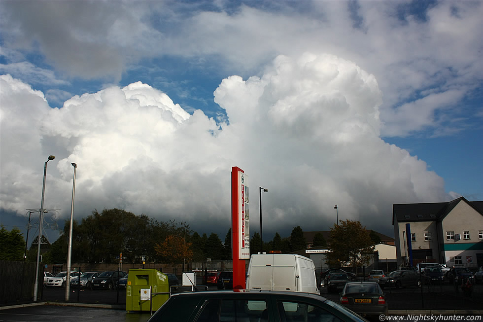
Located in Maghera on September 16th 2011 within the car park of a local supermarket when I spotted this nice line of convection fire suddenly during the afternoon once the cap broke allowing storm clouds to rapidly form. The leading edge was not worthy of mention however on the rear was an impressive updraught tower which began to expand explosively with nice hard edges and with good vertical wind shear tilting the updraught ahead of the inflow base, this was a good visual indication that future storms would be organized and more capable of severe weather, indeed later this afternoon in the same area this convection was located a highly sheared intense thunderstorm passed through with amazing rapidly rotating wall cloud and funnel along with associated vortices which made for a spectacular afternoon, check out the funnel cloud gallery to see more on this event, however it's visual clues like this that can alert trained observers to promising sky action which could happen later in the day, read the report for more information. * All images are available for sale in the form of photo prints, canvas or digital files for licensing, if you are interested in a purchase simply drop me an email.