 |
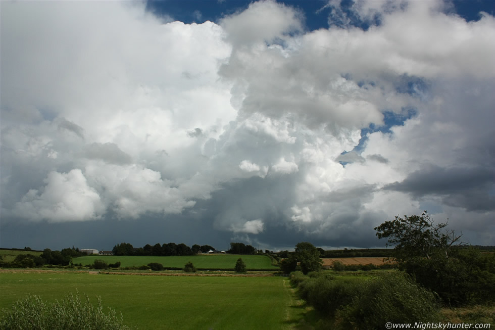
Remarkable sight on very warm early afternoon chase day, this multicell thunderstorm erupted into life rapidly in the very unstable uncapped air and formed this stunning explosive updraught at the rear of the storm, moving R to L with tilted aspect indicating very good wind shear and structure along the base and sides of the tower which hinted that this updraught was likely rotating for part of its life and hence in a quasi mesocyclone state, the forecast did mention that supercells were possible in N. Ireland this day. The main updraught to the L can be seen with precip core below which was producing lightning and flooding rain, I could hear the thunder rumbling angrily across the countryside from this distance. The scene was captured from Glenshane Road looking E towards the Antrim countryside on August 21st 2012, read the report for more information. * All images are available for sale in the form of photo prints, canvas or digital files for licensing, if you are interested in a purchase simply drop me an email.