 |
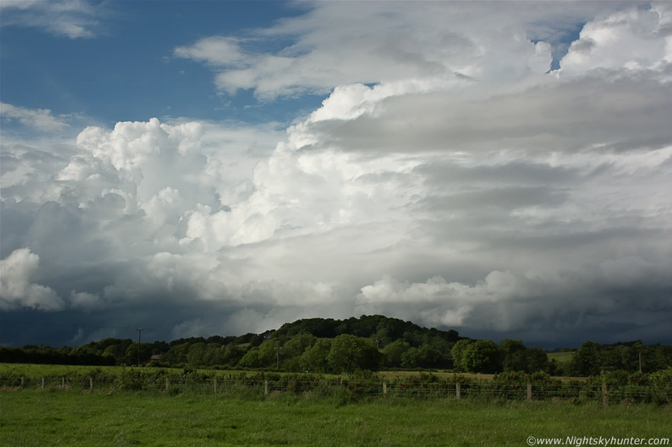
Maghera, June 27th 2012, before 17.00 a sudden surge of convection produced a wonderful looking line of towering cumulus clouds extending across the entire NW to NE skyline and as I watched from my back garden I could see updraughts exploding skyward so I grabbed my camera and a bottle of water and walked out the road for a look. So here I was sweating in the heat watching what was now a high precipitation multicell thunderstorm which appeared from nothing in such a short period of time, it was located a few miles away but I couldn't chase it without a car so I had to enjoy the sight from here.
The above image shows half of that line of cells with crisp updraughts and cb calvus towers all lit beautifully by the sun, the entire line had an impressive low level dark base with complex scud/outflow cloud practically touching the ground. The towers looked wonderful above the green sunlit fields below as they slowly drifted from L to R (SW to NE) across the blue sky. The dark base to the L was where a cluster of c-g lightning was striking to the NW of Maghera and the dark base to the R (which continued far out of frame) was the source of a very active battery of lightning which affected Garvagh, Coleraine, and the Antrim coastline with the radar showing strong red echoes from both locations, read the report for more information. * All images are available for sale in the form of photo prints, canvas or digital files for licensing, if you are interested in a purchase simply drop me an email.