
 |
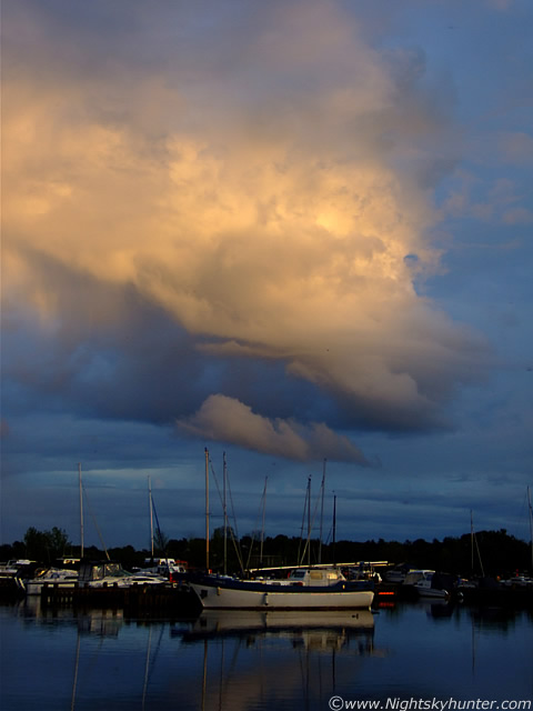
Cool scene. Just to note that none of the colours on any of these images have been altered in any way, these are just straight off the camera and resized.
 |
A little later I was on high ground looking over the location where the 'Maid of Antrim' was moored and spotted this. This is a large cell moving through the W sky from L to R flanked by large cumulus clouds with a cb at centre with wispy anvil. The colours here were breathtaking with a purple glow to the cell itself and intense orange and red colours catching the striated base. I seen something big to the R hanging down but couldn't get a good view of it because of those trees. This area would soon be a cause for some excitement, although I was unaware of this at the time.
 |
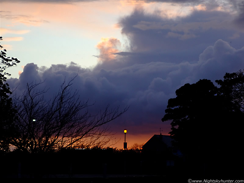
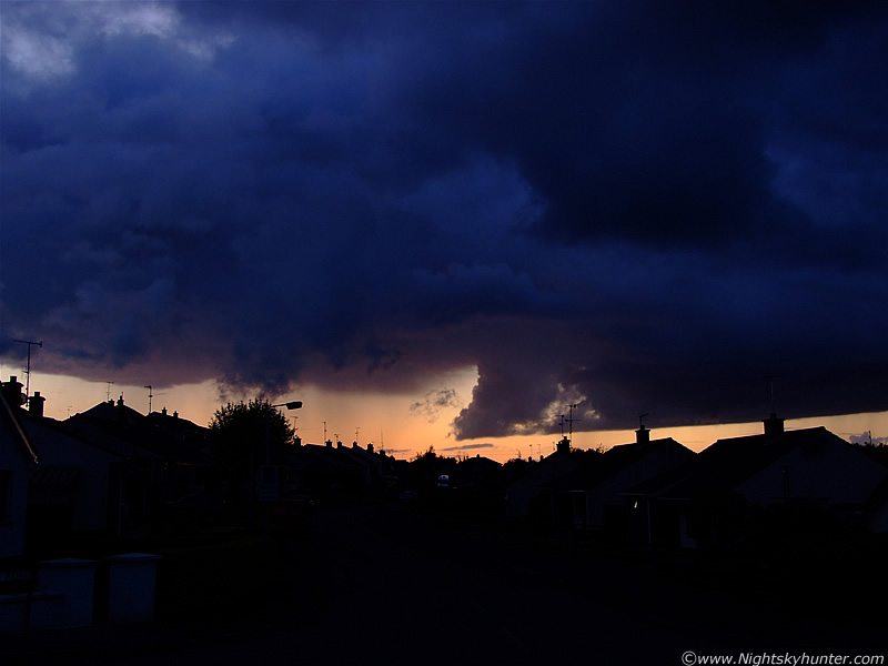
Meanwhile back in the NW there was a line of great looking convection catching the Sun. I had to walk along a wooden pier over the water where the moored boats are closed away from the public to get a good view. It was difficult trying to hand hold the camera at 250-300mm in such low light conditions. Considering that the Sun would soon be setting I was surprised how much these clouds were bubbling up.
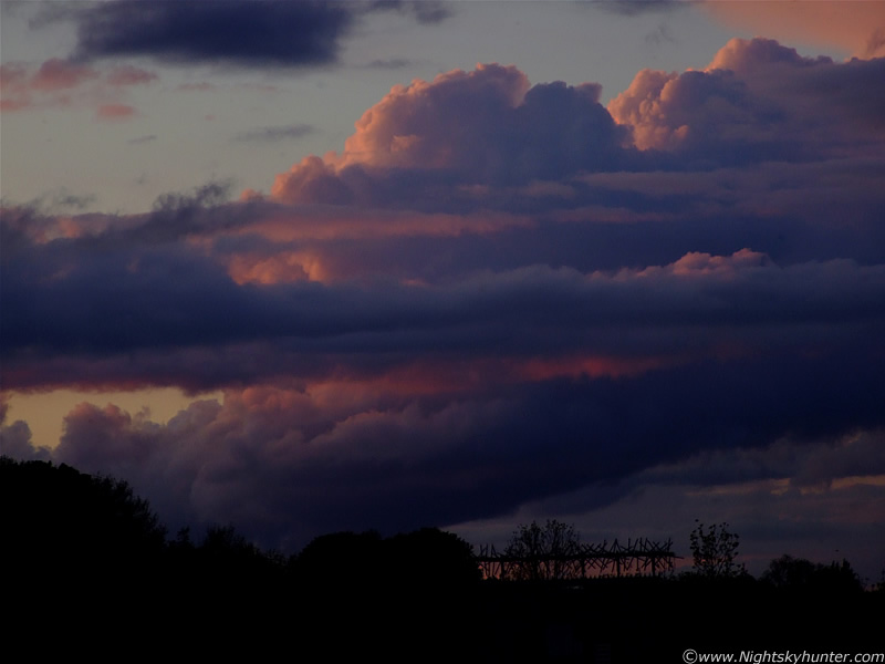 |
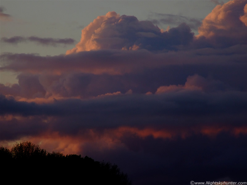
Wider shot of the same scene. This was really impressive looking. I love convective scenes at sunset, it's that magic window period of the day when any photographer worth his salt will be on the look out for long shadows, high contrast, depth, and rich colours for any subject. I took about a dozen images of this one scene at various focal lengths.
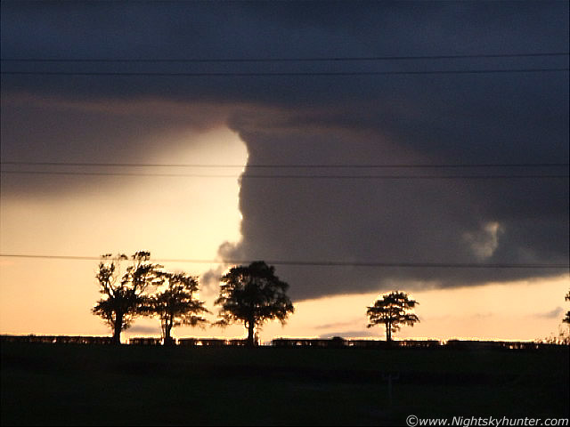
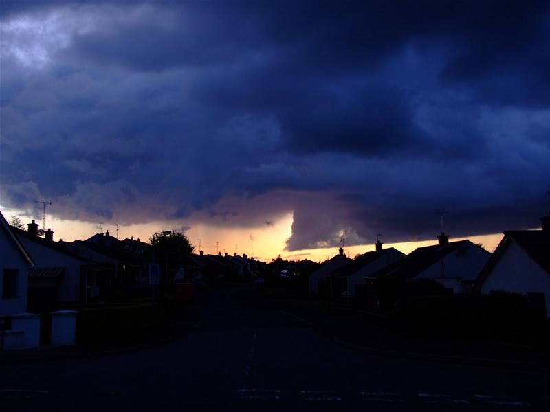
After this it was time to go. It must have been around 22.00 BST but I'm not sure. The sky was still bright, the Sun was not visible above any horizon obstructions but was still up. We drove out of Ballyronan and onto the country roads heading for Magherafelt, that was when I spotted the most menacing looking storm clouds I have ever seen to date. The cell I had imaged earlier (three up) had formed into a nasty entity. It was huge as it crossed the W skyline where it became partially back-lit and illuminated from below at the same time. The side of the cell was a combination of black and blue/purple vivid colours, the highly structured base was intense orange and red against a back ground of clear sky above the Sperrins which was a deep sand colour. Hanging down from the centre was a huge black solid wedge which seemed to be touching the ground, it looked for all the world like a huge tornado. A curved ridge ran in a horizontal direction above this lowering which was also lit red by the Sun. To the R, precip was falling in fine black streaks, and to the L, the precip was falling in pink and red strands, it was an awesome scene which I find very difficult to describe. What on Earth was that black thing though?. We could only get glimpses of it during breaks between passing houses and trees but we couldn't get stopped to get an image because of the traffic which was very frustrating, so I turned on the video mode on my camera and took this short video clip which I hope gives you some idea what it was like. Myself, and my Mum, had never seen anything like it before in our lives. I'm sure the other drivers on the road saw it too and speculated about what it was, some no doubt really did think it was a tornado. I didn't see any rotation during the brief glimpses I had so I knew it wasn't a vortex.
As we approached Magherafelt we got a good view of it, I was in a panic to get an image but time was running out because it was beginning to loose its form. I didn't want to miss that all important low Sun angle. This, in my opinion, was the convective photo opp of the year to date.
 |
Video still. Excuse the power lines, there are plenty of them out here.
 |
Another still.
 |
...and another.
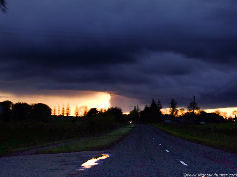 |
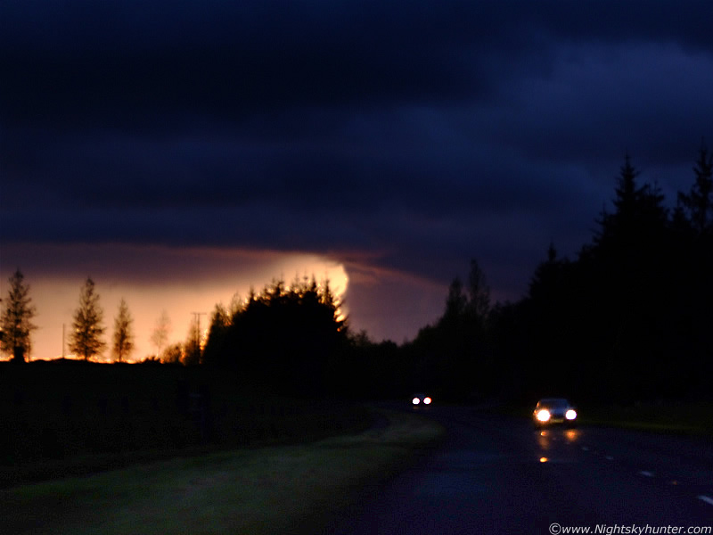
This is a badly taken still image I took through the front windscreen. Difficult to do in low light even when you are a passenger. Those colours are real, only better in reality. I had to use a grad filter to brighten up the road which is why it looks pixilated. It was extremely dark under that cell. I was expecting a rumble from it any time.
 |
Another through the window. The images and video do not do this thing justice. It was phenomenal, stunning, exceptional, and the most frightening daylight sight I have ever seen.
 |
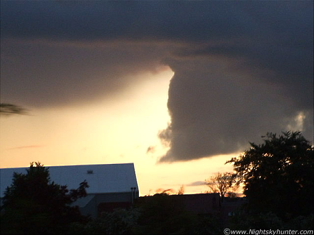
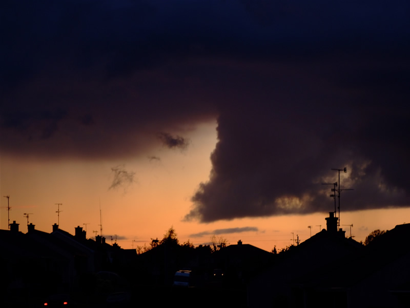
We went off the main road going into Magherafelt and found a single quiet road near a residential area which offered the only unobstructed view to the W. I ran out to the grass verge and could see the lowering between two rows of houses. It was decaying but at least I could get a few images now. It was obvious that this was the updraught region of the cell, possibly with a large wall cloud when we spotted it earlier at its most dramatic stage. This looked like something from the US.
 |
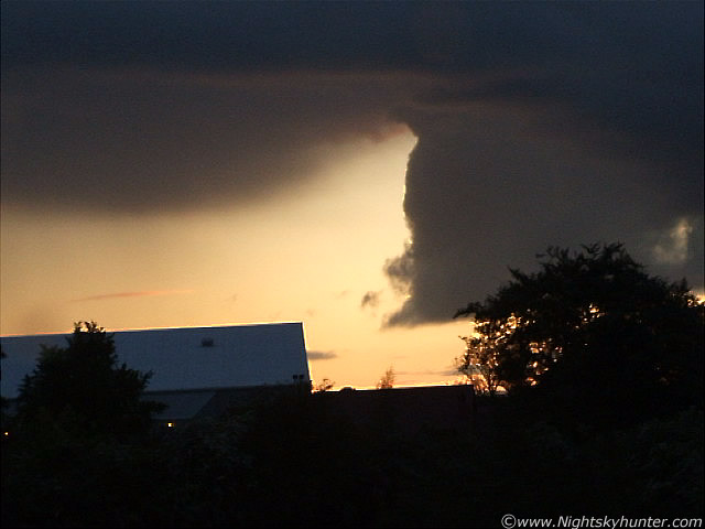
Great colours and structure.
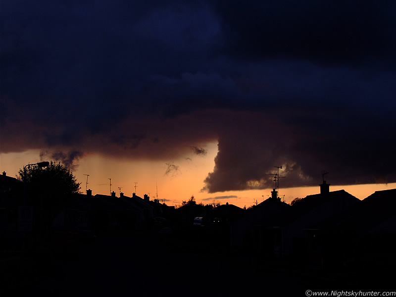 |
This was breathtaking. Note the precip falling from the L. I suspect this was actually two cells which merged together, although I'm just speculating. I was praying that another funnel would drop, but that would be asking too much this evening. I have always wanted to get images of a spectacular funnel cloud against a sunset sky like this, it has to happen some time!.
 |
It would be interesting to find out if others had seen this earlier and if any rotation was visible. I doubt it though, but it sure made up for it by its menacing appearance.
We then drove home, the cell was visible from Tobermore where it dropped a moderate shower in the area then when we arrived home at Maghera it was visible to the E after sunset and still dropping precip. It must have passed through here at the N end of town. What an evening, and too think that earlier in the day I was lamenting over missing everything, if only I knew that a few hours later I would see a funnel cloud and stunning storm clouds at sunset. I'm glad I took up that offer to take our Dog out after all, maybe there were higher forces at work and that it was all meant to be, I'm open to that idea. In summary, the 2009 convective season in N. Ireland has been excellent to date, I have already had four days of thunder events and observed two funnel clouds in the same month and this is still early in the season. The severe stuff has yet to come, bring it on!. Thanks for reading.
Martin McKenna