

|
|
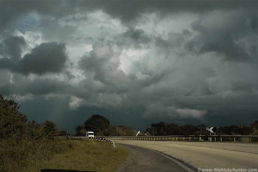
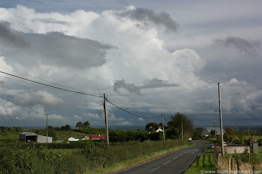
Summer of 2010 has ended with a bang!, the set-up was quite favourable for thunderstorm formation with 1000 CAPE, LI's of -3, upper troughing from the W and SWly unstable flow around a low pressure centre further N so showers and storms were expected to break out during the afternoon and evening in a sheared environment so some organisation was certain, and although TORRO had no forecast issued it seemed likely that funnels and brief tornadoes could form from any stronger cells given the shear profile. All of this was going on ahead of another front pushing in from the W over the Atlantic in conjunction with good solar insolation and decent dew points so there was sufficient lift and moisture for exciting convective weather. The Met Office had issued a severe weather warning for thunderstorms and heavy rainfall with a risk of flooding due to the slow moving nature of the storms.
I was a little skeptical of the chances during the previous day since similar good CAPE values had produced poor days due to a cap or warm inversion aloft, lack of shear, and convergence, however this day had better prospects because of the shear. I was expecting one or two random storms at best however I was pleasantly surprised by what did happen. As it turned out this was the best day of September storms this country as seen in recent years and certainly the best quality cells and convection I have personally seen at this time of year. There where many good storms across parts of the country, the Republic of Ireland, N. Ireland, and W Scotland. In NI all the action was located to the W, E, and NE of Lough Neagh with intense storms over Co. Antrim and strong storms further N near coastal areas and over the N Atlantic itself, some of these storms made it over to the coast of Scotland while maintaining strong radar signatures for a lengthy period of time. UK chaser Danny Power informed that he had spotted a hook echo on the high resolution radar over the coast from a particularly nasty storm, it's likely that a funnel or waterspout/tornado may have formed in that area, I haven't heard of any visual reports from that location although it's likely that any vortex which did form was embedded in precip or hidden by cloud from other cells/showers. In hindsight I wish I had opted for the coast to have seen that however I couldn't be in two or more places at the same time.
I had a really fun chase day, this time I was chasing on my own and ended up spending the entire day out on the road trying my best to catch a piece of the action, I failed by making a few bad decisions at times however on other occasions I got close to good cells which decided to go quiet on me when I arrived only for me to chase after another target and that same cell would come to life again when I was too far away to turn back, nature really played games with me so it was a busy action packed day with little time for rest, nature threw me a curved ball too by generating storms after dark so talk about a wild and unexpected chase day, such is the nature of pursuing storms. Chasing rarely, if ever, goes to according to plan but this is what makes it exciting.
I ended up chasing in Maghera, Tobermore, Lavy, Toome, Knockloughrim, Ballyronan, and Magherafelt (twice). I even ended up on roads which I had never seen before in my life, these kind of hidden and obscure country roads and lanes leading into unknown territory made the day more exciting. My car really got put through it's paces due to fast navigating on various road surfaces and constant starting and stopping at sudden moments to grab a shot and move on to another location, by the time I got home at the end of the day I had 32 miles of fuel left in the tank. The scenery was worth it though because this was proper chasing weather due to a constant supply of cells on view at any one time, at any given moment I had three cells/storms in view so I had to pick which one to pursue based on visual appearance and road options, this was such a treat and the kind of storms we used to get all the time, especially when compared to this year when I would be happy to see one good cell. The main obstacle for me on this day where trees, hedges, power lines, and telegraph poles, it seemed everywhere I went any photo opportunity was raped by the presence of these man made objects, I just couldn't escape from them so I didn't get much in the way of high photogenic rewards, at other times I couldn't get off main roads for a shot and all I could do was take a crappy snap through the window which is not something you want to be doing very often. Despite all this I came home with 160 images, below are just a few.
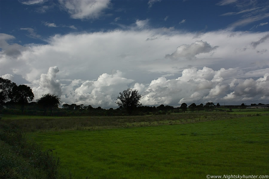 |
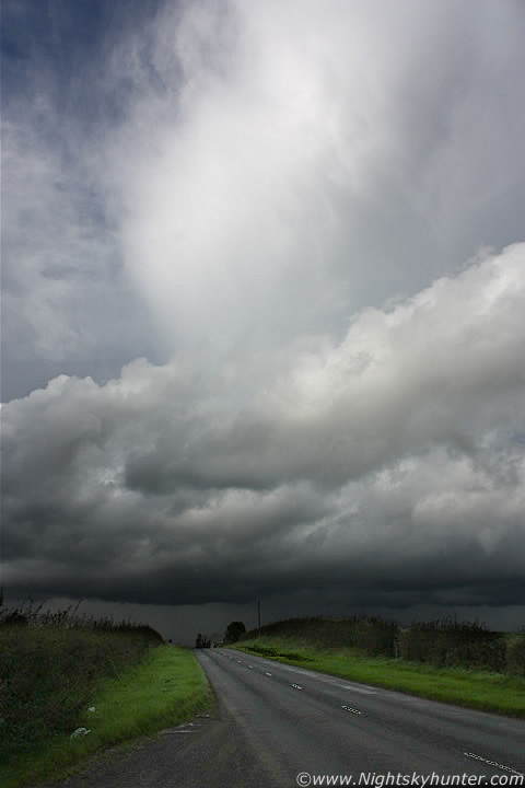
The action began after 12.30 when convection exploded into life, the quality of this rapid vertical cloud development convinced me that there was going to be good storms this day. I watched flat strips of cloud bubble up into decent crisp towers within 5 min's which was very impressive. During lunch time I went for a short drive to check the sky, I watched the situation from the Moyola bridge and spotted strong inflow motion and rotating scud under a line of towers to the E of Tobermore and for a while I thought a funnel was going to spin up over the driving range. The sky turned dark to the S however the convection began to turn mushy so I returned home to check the net.
Things had kicked off, Danny Power was keeping me updated on the situation via Facebook and informed me of c-g sferics to the W/SW of Lough Neagh, the storms where moving N/NE so that could be a potential intercept so I hit the road for the second time. I drove S and headed for Ballyronan, I was driving straight towards a large dark mass in the sky which was obviously that storm, however my attention was stolen by this other monster cell to the NW so I quickly pulled over for a shot as the wheels skidded to a halt. This was a storm miles away over the Sperrins which had a huge solid anvil of considerable length, the above image is 18mm so you can appreciate how large and far away it was. Moving L to R, check out the solid back edge to the L, this beast was spitting out c-gs and I was tempted to go home again and chase it however I decided to check out the S cell first to see what it was doing.
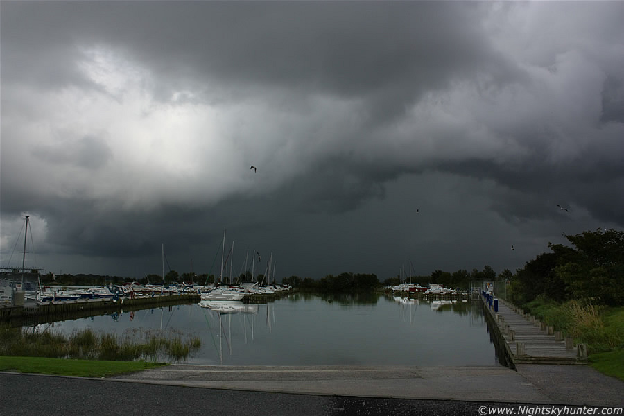 |
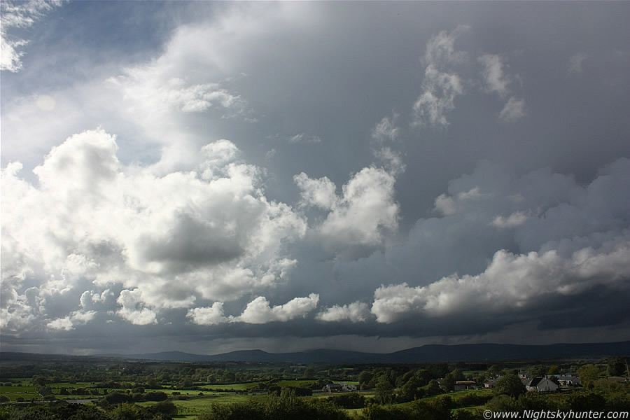
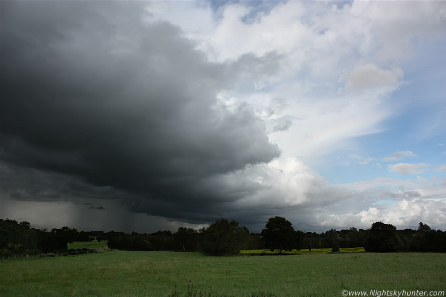
I parked at Ballyronan Marina on the NW shore of Lough Neagh under rain and waited. The sky was full of dark clouds and after 15 min's of listening to the radio as the wipers lazily battled with the raindrops the precip stopped and the clouds parted. Then I saw this large cell over the Lough on the E side of the basin moving R to L and away from me to the NE. It had nasty looking structure and a strong precip core and it was intensifying fast, you can see the bulging gust front to the L, this view is side-on to the cell.
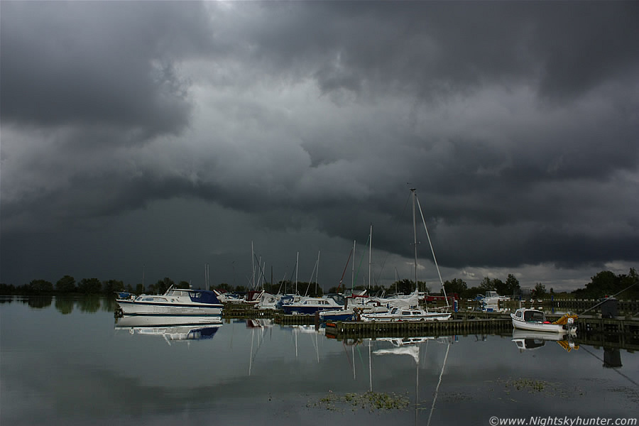 |
There where only a couple of people in the area so I was happy to walk around the shore taking images without anyone disturbing me. The storm clouds looked cool reflecting on the water, the precip core had a very subtle green colour which could suggest hail falling, the upper air temps were between -20 and -30 dec C with good lapse rates so hail isn't exactly surprising. A long line of black updraught towers fed into the back of the cell (R), and yes there was even rotation in that region above the trees to the far R. I never did get the funnel or waterspout shot I have been yearning for for so long, perhaps next time.
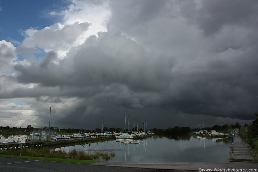 |
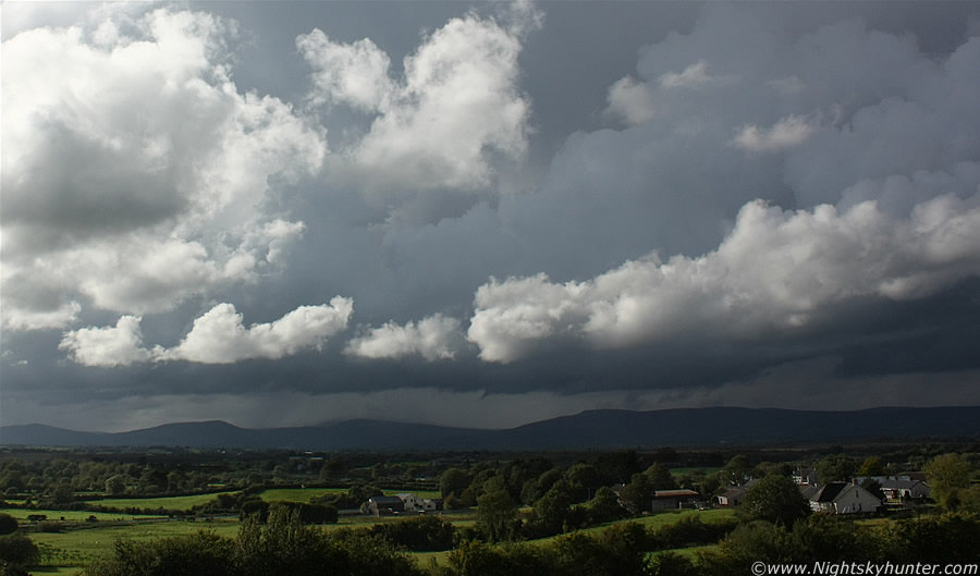
This is a little later, that's not a funnel to the LOC, just cloud hitchhiking on the W side of the precip area near the gust front, an outflow feature. The clouds broke open further and that was when I saw the top of this storm and I was blown away by the sight, I was expecting decent towers or an anvil however I was taken back by the incredible height of those enormous updraught towers and big anvil overhead despite the base of the cell being over the E side of the Lough, the sight of the anvil/updraughts towering that tall from this actually gave me an adrenalin dump. The cell was quiet at this stage, by that I mean I saw no lightning or heard thunder which was strange since it looked like a storm for certain, perhaps the Lough was affecting it in some manner, if so then it should come to life soon as it moved NE overland into Antrim. While I was contemplating this I saw three other stunning cbs with impressive thick anvils miles away to the W, SW, and N then a beauty popped up behind this cell over the Lough, I felt like a Fox in a Hen house and didn't know what to do next. I ran out of credit on my phone so I couldn't text anyone for an update on the radar.
 |
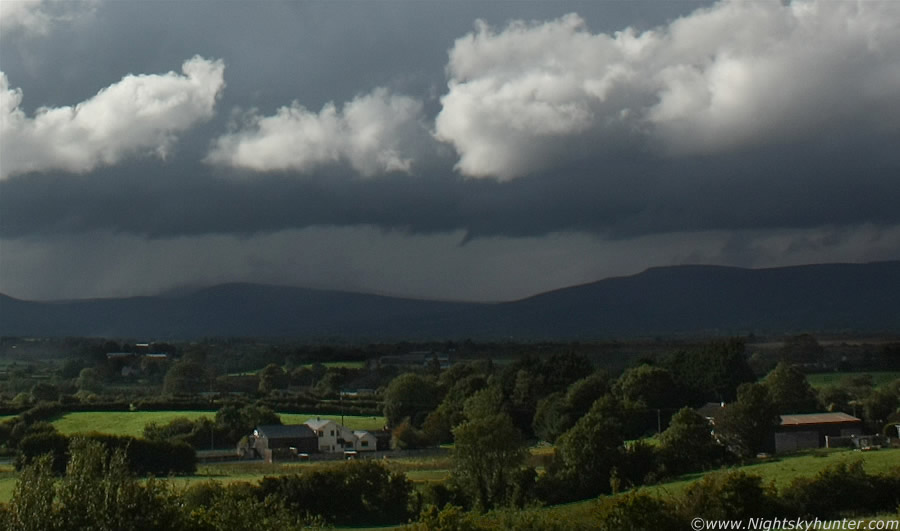
I wasted no time and went back on the road heading NE in pursuit of the came cell which had just exited the Lough. This is outside Toome near the river, I pulled over before crossing the bridge to take this shot looking at the back of my cell as it continued into the distance towards Antrim, you can see a shaft of hail falling among the precip. I later learned that my instincts were correct about this cell, it switched on producing c-gs over Antrim with thunder also reported from it in Randalstown. I didn't pursue this one any further because it was gaining ground on me and I had no idea of it's future so I let it go as there was plenty more going on around me.
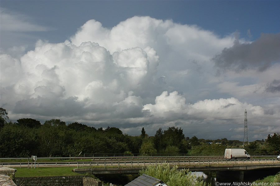 |
I parked the car and went for a walk up the stone bridge to take in the scene, this is the back of another cell to the NW with young towers behind, the bridge in the frame was where I was parked for the previous image. I saw at least four major cells all around me, the best was a beast which had an anvil and solid profile similar to a US cell, the structure on the back of it was unreal however I couldn't get a decent image of it due to the tree layout in the foreground and the Sun being in the same area of sky, that cell was probably a storm on the far W side of the Sperrins and way too far for me to reach in time, ironically I would probably have had a great view of it from home. I decided I would follow this cell since it was new and closer than the rest, if I took the road W then I should get a view to the side, or perhaps even rear of the above cell incase there where funnels.
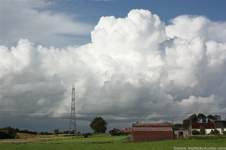 |
I drove west for a few miles outside Magherafelt and pulled over for a shot of the cell in the previous image, the old cell is to the upper R in the distance, however these new towers exploded to life and looked great catching the full brilliance of the Sun. This would have been really nice if those power lines weren't there, you know your'e in the Toome area when you see those big pylons. Check out the man standing on top of the barn, he must be working on the roof, I doubt he was doing a bit of storm spotting lol.
 |
I arrived in Magherafelt, changed direction, and went N again in the general direction towards home. A large cell crossed the sky in front of me and looked quite a sight through the windscreen however I couldn't risk a sneaky shot on this road, I scanned in vain for a place to pull over and had no joy so I missed a good image, meanwhile I was getting closer and lost the photo opp as the thing now filled a huge chunk of the sky. I eventually found an exit and got this snap in the country, this is the side of that big W storm, it's so large it covered a vast area of sky, it fills this image and would require four 18mm frames to take in it's length, it pretty much looks like a wall here with the dark storm colours, the anvil and towers are high overhead and mostly behind cloud. In the foreground is new convection flanking the cell bursting up in the late afternoon heat, that single tower would become big itself 10 min's later.
 |
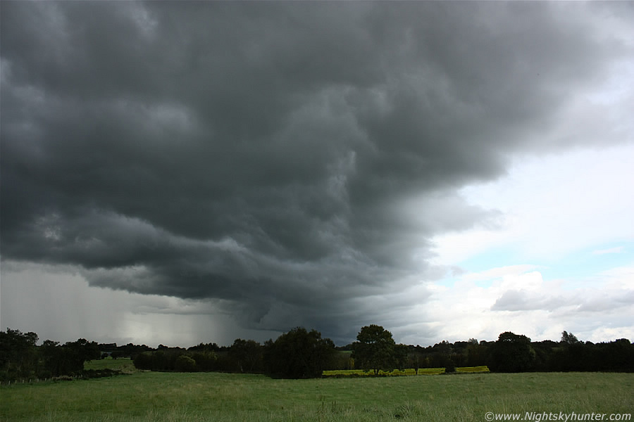
I chased after it feeling frustrated by being stuck on the road every time something cool happened so I decided to pull up for a break on high ground outside Knockloughrim looking W to NW across the country towards the Sperrins. This is the back of the cell with line of new new towers going up, you can see a portion of the back anvil, there was no mammatus on it either so it was still a healthy storm. This was a nightmare to photograph since the Sun was close by and contrasting with the dark storm clouds at ground level, I couldn't see a thing on the LCD screen either due to solar glare. The cell is moving L to R in the frame and extends far out of frame to the R (NE) for miles. Sferics charts showed active c-gs from this storm but I was too far away to hear the rumbles. The annoying thing is that if I had went N instead of S earlier today and positioned myself W of Glenshane, or N of there, then I would have been taking video of lightning now. What's that lowering to the ROC hanging from the base of the cell?
 |
When I first spotted that lowering I immediately thought it looked like a funnel cloud, however I dismissed it as scud because I couldn't see rotation at this great distance. When I posted the image on Facebook others suggested it could be a funnel so I had another look at the high resolution image and cropped it in and sure enough the feature held it's form very well, it's substantial, has a smooth appearance, and stands out quite well in the above crop, this was 15.52 BST.
 |
This is a very deep crop and the image is on the verge of breaking down however the lowering still looks in fine form considering how deep I've zoomed in on the 18mm frame. The more I examine it the more I'm confident that this is indeed a small funnel cloud at considerable distance from the camera. It looks to be close to the E side of the Sperrins and N of Slieve Gallion, it's possible that drivers on the Glenshane Pass may have seen it, or perhaps not. The best view would have been on the flat ground a mile or so W for anyone who lives in those country homes. I sent a report and these images to Dr. John Tyrrell at TORRO for an expert opinion. He believes given the synoptics at the time that this certainly could be a funnel cloud, this is his response...
''Very interesting. I looked at the images and related them to the OS maps I have with me. If the view is to the W - NW from Knockcloghrim, then the two mountains in the pictures are probably Mullaghmore / Slievemoyle to the right (north), Crockmore to the south of that, then possibly Slieve Gallion as the third. The 'funnel' then appears in the line of sight between the first two, but is probably in front of them (towards you). Since the Castor Bay noon upper air sounding shows the main airflow above the ground from the southwest, I guess the significant flow towards the area of the funnel is from the direction of the Moyola River valley.
Here's a possibility...
If the set up is as I describe above, there would be occasions when there would be marked convergence of airflow as it was squeezed between high ground to the W and other high ground to the E in the upper reaches of the Moyola River valley. But as the airflow travels down the valley it descends sharply in the well defined valley. The valley is 240 metres at McConnamays Bridge but 80 metres at Disert Bridge. Any vorticity occurring downstream of the convergence zone may be stretched as a result. This is a set up that can sometimes produce small vertical vortices and this may be one of them. Add to this that there are two other ingredients that provide a relatively favourable environment for a funnel.
1. CAPE values that were low, but positive, which were spread through most of the troposphere. These would certainly help the required stretching process.
2. Vertical wind speed shear from 10-55 kts over a considerable depth. This would help with the development of vorticity.
So, I think you have something. The evidence suggests that this may well have been a funnel cloud, even though there was no eyewitness to observe the actual rotation''.
I then glanced behind me to the E and wow!, above the trees where the tops of a remarkable cell, it looked like serious business and the rock solid profile and sheared updraught hinted at tornado potential, I was blown away by the quality of this thing and had never seen anything like it in September before so I gave chase expecting to hit the jackpot.
 |
I don't know where I was here, I just kept driving E on quiet country roads and my view was blocked by trees, it felt like I was driving for a long time and I began to loose hope. I eventually drove to the top of a hill and pulled over. I had a great view looking E/NE at this monster cell however my chase plans were terminated by distance. I had been completely fooled by my previous first sighting, this thing was way too far away, easily tens of miles. To indicate how big this is the above image is 18mm wide angle and the storm is over E Antrim, it takes a big cell to show up with any size on an 18mm frame at that range!. The time was 16.03 BST, I was standing on a tall grass verge to get this shot but unfortunately the telegraph poles ruined it. This image does not do justice to how impressive this looked with the naked eye.
The cell is massive, covering a large area in azimuth and completely solid along it's entire length and the base of it is very low to the ground and dumping intense precip along a S to N line over the Antrim countryside. Check out the cirrus clouds to the E of the cell blowing hard beside it in the upper level winds. The menacing updraughts at the rear of the cell looked amazing visually - solid with knuckles and explosive. In this view the storm is moving R to L, however this is obvious to anyone who has studied storm structure. That could be an overshooting top on the main updraught although it's difficult to say if I was looking at a solid anvil side-on or just a strong updraught. I suspect this cell was severe for a period, the radar was strong and the sferics charts showed plenty of c-gs from it, I would love to hear from anyone who was under this one at the time.
 |
Same scene at 33mm. I love healthy strong convection like this and it pained me to know that I would never have got close enough to it as that time had passed. Judging by its path this storm may have been responsible for some of the rumbling in S Antrim before this. I stood here for a while dealing with a mix of emotions, cursing myself for not being on this cell but at the same time enjoying this stunning majestic sight while catching rays from a surprisingly warm September Sun, it was certainly much warmer than what GFS had predicted, perhaps this helped the storms a great deal. My car was parked on the side of the road out of frame to the L beside a small house, I saw shadows moving behind the window, they must have thought they had a visitor or a door to door sales man was about to knock on their door, they spotted me standing here with the camera and no doubt wondered what on Earth I was doing so I got back in the car, did a 3-point turn, and headed back N.
 |
Now further N and once a again I pulled over for a shot, before this I had been down three small roads which I had never seen before in my life, all I wanted was a good view to the N however I ended up driving through a maze of narrow roads, some of them could be classified as dirt roads, then I ended up at a dead end at the entrance to a small farm, 'The Hills Have Eyes' came to mind so I drove back onto the main with haste. It was really boiling in the car despite all the windows down and cold air on, I was sweating through my jeans and shirt, this really felt like chasing in June. Anyway, this is the back end of the earlier cell over the Sperrins which is now in the N sky sector, moving L to R, you can see the big anvil which I can't even fit in at 18mm. I advanced N and realised this cell and associated line where near Maghera, my home town, so I went in that direction.
 |
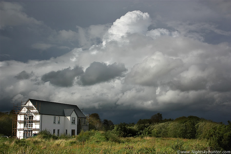
16.28 BST and now parked up outside Maghera on Crewe Road looking N. There seemed to be significant convergence taking place here and it's very difficult for me to explain what was going on in relation to the rest of the sky and paint a simple mental image for the reader. This is the very N end of that big cell on the previous images, new cells and showers are forming where it meets/converges with another line of convection further W (behind this one), they are moving slowly L to R and into the distance while interacting. This line of convection is huge, if straight head is 12 o'clock then the other end of this line would be over my L shoulder and behind at 7 o' clock. The dark clouds are a line of towers and new cbs miles long merging with the big Sperrins anvil which itself was merging with a new line out W, the result is a big unpredictable mass of storm clouds. The old anvil is getting shredded off by wind shear (stronger winds with height) and getting blown down range to the N while new towers and anvils form above the new line. Those with keen eyes might spot the segment of rainbow below the old anvil from precip in the air, this scene was difficult to expose correctly due to the large dynamic range.
 |
This is the same scene at the same location 10 min's later which shows how rapidly things were developing. Precip was breaking out under the entire length of the line however the 'occlusion area' (for want of a better word) where the old cell and new are merging became extremely interesting. That middle area was where the action was, for a period of time it was rock solid in there and a large bowl-shaped feature formed under the roof of the new updraught, a scene which looked crazy, solid blocks of cloud appeared and formed a wall cloud with strange motion and for a time I was convinced a funnel or even tornado was going to drop from it. This image is looking at the rear of the lead updraught, you can still see a lowering above the tree, I just couldn't get a decent image of it with the amazing structure 5 min's before this. I was contemplating moving N to Swatragh or Garvagh to follow this baby when I got a phone call which changed my plan, I had to go back to Magherafelt immediately to do an important message before 17.30 so I had to leave this scene and go back S. I still saw great towers and more rotation on the road but I kept looking over my L shoulder at that cell I left behind, it looked great with amazing structure and I wished I could be near it. All was not lost however as I had a delicious Subway for dinner in the car park in Magherafelt while watching new towers over Slieve Gallion.
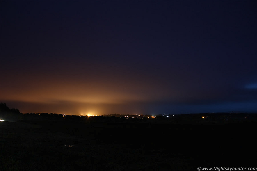 |
The evening was uneventful with dark overcast skies and showers, after dark I got a surprise when I suddenly heard a rumble of thunder near Maghera, that was surprising because the storms were supposed to ease during the evening as solar heating waned, I went outside to check the sky, then a bright flash of lightning lit up the clouds followed by another loud rumble soon afterwards, I went into combat mode, this would be a chance for rare night lightning, the radar showed an intense band of cells to the W of Maghera with a tail of cells to the SW near Lough Neagh, the entire system was moving N and slightly E so it was rite on me, sferics charts showed plenty of c-gs so it was game on. I met Declan O'Doherty and together we drove out into the night to catch lightning, we found a good location on a high hill looking SW over the town lights then began taking exposures, a couple of c-g captures would be a great end to the day.
The above is one of a dozen patrol images taken, you can see the edge of the storm in the distance and the lights illuminating the precip. Then the lightning decides to stop - unbelievable!. The storm was moving N yet from the N we could see other cloud moving S, it must have been convergence still at work. The precip from the ex-storm in the N hit us hard and what followed can only be described as a monsoon, the core of the storm was unbelievable, complete torrential rain which reduced visibility, it was like driving through a wall of water with big drops hitting the car at phenomenal speed and hail bouncing of the ground, within min's the roads were flooded. It was quite exciting driving through it, at one stage we passed another car which threw up a huge wave of water which seemed to wash straight over the car with a roar, we stopped and waited for it to ease. Conor McDonald text me, he was alerting me to big convection going up on the way home from Belfast and suspected it was due to cooling cloud tops. We waited but no more lightning appeared however it was a good attempt anyway. Quite an action packed weather day which I enjoyed very much, I wonder what Autumn will produce?. Thanks for reading.
Martin McKenna